avia.wikisort.org - Aerodrome
The Vrsar Crljenka Airport[1] is an airport for general aviation in Croatia. It is located about 2 km southeast of Vrsar.
Vrsar airport Zračna luka Vrsar/ "Crljenka" | |||||||||||
|---|---|---|---|---|---|---|---|---|---|---|---|
 | |||||||||||
| Summary | |||||||||||
| Airport type | Civil | ||||||||||
| Operator | North Adria Aviation | ||||||||||
| Serves | Vrsar | ||||||||||
| Location | Vrsar, Croatia | ||||||||||
| Elevation AMSL | 121 ft / 37 m | ||||||||||
| Coordinates | 45°8′30.12″N 13°37′49.73″E | ||||||||||
| Website | |||||||||||
| Map | |||||||||||
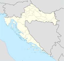 LDPV Location in Croatia | |||||||||||
| Runways | |||||||||||
| |||||||||||
The runway is 700m long and 18m wide. It is oriented north–south (runway mark 36–18). The altitude of the airport is 37 m. The runway thresholds are at 42.3m above sea level in the north (139') and 33.2 m above sea level (109') in the south, so that with a height difference of 9.1m (10') the runway has an inclination of 1.9 ° and 1.3%, respectively. The surface of the runway, the rolls and the platform are in asphalt.[1][2][3]
Vrsar Airport was built in 1976. It is equipped to accommodate and maintain small-sized aircraft: it has a fuel pump, a hangar, an aircraft service, a restaurant and customs office. The operator is North Adria Aviation from Vrsar.[4] Navigation services (flight plan, meteorological situation and air traffic control) are performed by the operator via Pula Airport.[5]
It is intended for occasional air traffic and is involved in the following activities:[5]
- Reception and maintenance of small-sized aircraft
- Panoramic flights over Istria
- Flights to domestic and foreign airports
- Sports flights (parachuting, training and competitions)
- Flights of medical services and rescue services
- Fire service flights
- Flights for advertising (throwing leaflets and pulling banners)
The airport is registered for domestic and foreign air traffic. For foreign air traffic, the airport is open from April to November.
Near the airport there is a memorial to Dragan Garvan and Dragutin Barić, members of the Croatian Air Force and air defense killed in the Croatian War of Independence who were brutally killed on December 21, 1991 during the Yugoslav army air attack on Crljenka airport.[6] The shells of the cluster bomb were found 21 years later near the sports airport.[7]
In 1998 Vrsar hosted the XXIV World Parachuting Championship, which was attended by 245 competitors.[8]
| Vrsar Airport | |||
|---|---|---|---|
 |
 |
 |
 |
| Aerial view over the Lim Channel to the north | Space for passengers | Part of a platform, with a fuel pump | Customs service |
References
- Podatci na web stranici Sky Vector
- Podatci na stranici Falling Rain
- VFR priručnik - LDPV Aerodrom Vrsar/ Crljenka, Hrvatska kontrola zračne plovidbe. (objavljeno 2. travnja 2015., pristupljeno 27. kolovoza 2015.)
- "Popis registriranih aerodroma u Republici Hrvatskoj", s web stranice Hrvatske agencije za civilno zrakoplovstvo
- Zračna luka Vrsar na web stranici Vrsara
- Porestina.info Mladen Pisak, vrsar.hr: Komemoracija povodom 23. godišnjice pogibije hrvatskih branitelja na aerodromu Crljenka, 22. prosinca 2014. (pristupljeno 16. kolovoza 2015.)
- Istarski.hr Ozren Skender pronašao "zvončić" kazetne bombe u blizini sportskog aerodroma u Vrsaru 4. siječnja 2019. (pristupljeno 9. travnja 2020.)
- Archive of British World Championships Teams
External links
- Zračna luka Vrsar na Istarskoj enciklopediji
- Aeronautičke karte Sky Vector
- Podatci o zračnoj luci Vrsar na The Great Circle Mapper
На других языках
[de] Flugplatz Vrsar
Der Flugplatz Vrsar befindet sich etwa 3,5 Kilometer südöstlich von Vrsar, auf der Halbinsel Istrien in Kroatien. Er wird von der Allgemeinen Luftfahrt angeflogen. Er ist seit 2018 wieder ganzjährig für den internationalen Flugverkehr geöffnet. Außerdem wird der Flugplatz unter anderem von Sportflugzeugen genutzt, die ganzjährig Panorama- und Fallschirmflüge durchführen.[1] Der Betreiber ist die North Adria Aviation. Der ICAO-Code lautet LDPV.[2] Vrsar Radio hat die Frequenz 126,650 MHz.- [en] Vrsar Crljenka Airport
Другой контент может иметь иную лицензию. Перед использованием материалов сайта WikiSort.org внимательно изучите правила лицензирования конкретных элементов наполнения сайта.
WikiSort.org - проект по пересортировке и дополнению контента Википедии