avia.wikisort.org - Aérodrome
L’aéroport international de Tapachula (code IATA : TAP • code OACI : MMTP • code DGAC M. : TAP), en espagnol Aeropuerto Internacional de Tapachula, est un aéroport international situé à Tapachula dans l'État du Chiapas au Mexique. C'est l'aéroport le plus au sud du pays. Il assure le trafic aérien national et international pour la ville de Tapachula, le port de Chiapas et la région de Soconusco.

| Aéroport international de Tapachula Aeropuerto Internacional de Tapachula (es) | ||||||||||

| ||||||||||
| Localisation | ||||||||||
|---|---|---|---|---|---|---|---|---|---|---|
| Pays | ||||||||||
| Ville | Tapachula | |||||||||
| Coordonnées | 14° 47′ 40″ nord, 92° 22′ 12″ ouest | |||||||||
| Altitude | 30 m (98 ft) | |||||||||
| Informations aéronautiques | ||||||||||
| Code IATA | TAP | |||||||||
| Code OACI | MMTP | |||||||||
| Code DGAC-M | TAP | |||||||||
| Type d'aéroport | civil | |||||||||
| Gestionnaire | Grupo Aeroportuario del Sureste | |||||||||
|
||||||||||
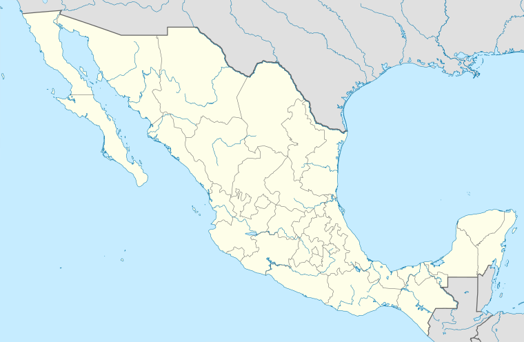
| Géolocalisation sur la carte : Mexique
| ||||||||||
| modifier |
||||||||||
L'aéroport est exploité par Grupo Aeroportuario del Sureste (ASUR) et propose actuellement des vols commerciaux vers Mexico et Guadalajara. 2018 a été l'année la plus occupée avec 330 619 passagers, soit une augmentation de 13 % par rapport à 2017.
Situation

|
Compagnies aériennes et destinations
| Compagnies | Destinations |
|---|---|
| Aeroméxico | en saison : Mexico-B. Juárez |
| Aeroméxico Connect | Mexico-B. Juárez |
| Volaris | Guadalajara-M. Hidalgo y Costilla, Mexico-B. Juárez, Tijuana-A. L. Rodríguez [1] |
Statistiques
Voir la requête brute et les sources sur Wikidata.
Itinéraires les plus fréquentés
| Rang | Ville | Les passagers | Classement | Compagnie aérienne |
|---|---|---|---|---|
| 1 | 166 070 | Aeroméxico, Aeroméxico Connect, Volaris | ||
| 2 | 1 513 | Volaris | ||
| 3 | 233 | |||
| 4 | 69 | |||
| 5 | 60 | |||
| 6 | 53 | |||
| 7 | 37 | |||
| 8 | 33 | |||
| 9 | 21 |
Voir également
Références
- « Volaris adds Tijuana – Tapachula from late-Oct 2019 », Routes Online, (consulté le )
- (es) « Traffic Statistics by Airline », Secretaría de Comunicaciones y Transportes, (consulté le )
Liens externes
- Tapachula Intl. Aéroport
- World Aero Data Données à jour en octobre 2006.
- Portail de l’aéronautique
- Portail du Mexique
На других языках
[de] Flughafen Tapachula
Der Flughafen Tapachula (spanisch Aeropuerto Internacional de Tapachula) ist ein internationaler Flughafen bei der Großstadt Tapachula im Südosten des Bundesstaats Chiapas nahe der Pazikikküste Mexikos und der Grenze zu Guatemala. Ein Teil des Flughafens wird militärisch genutzt.[en] Tapachula International Airport
Tapachula International Airport (IATA: TAP, ICAO: MMTP), Aeropuerto Internacional de Tapachula, is an international airport located at Tapachula, Chiapas, is Mexico's southernmost airport. It handles national and international air traffic for the city of Tapachula, Port of Chiapas and the Soconusco region.[es] Aeropuerto Internacional de Tapachula
El Aeropuerto Internacional de Tapachula (Código IATA: TAP - Código OACI: MMTP - Código DGAC: TAP[1]), es un aeropuerto localizado en Tapachula, Chiapas, México, cerca de la Frontera entre Guatemala y México , y es el aeropuerto más meridional de México. Se ocupa del tráfico aéreo nacional e internacional de la ciudad de Tapachula y Puerto Chiapas.- [fr] Aéroport international de Tapachula
Текст в блоке "Читать" взят с сайта "Википедия" и доступен по лицензии Creative Commons Attribution-ShareAlike; в отдельных случаях могут действовать дополнительные условия.
Другой контент может иметь иную лицензию. Перед использованием материалов сайта WikiSort.org внимательно изучите правила лицензирования конкретных элементов наполнения сайта.
Другой контент может иметь иную лицензию. Перед использованием материалов сайта WikiSort.org внимательно изучите правила лицензирования конкретных элементов наполнения сайта.
2019-2025
WikiSort.org - проект по пересортировке и дополнению контента Википедии
WikiSort.org - проект по пересортировке и дополнению контента Википедии
