avia.wikisort.org - Aerodrome
Brookhaven Calabro Airport (IATA: WSH, ICAO: KHWV, FAA LID: HWV) is a public airport located one mile (1.6 km) north of the central business district of Shirley, in Suffolk County, New York, United States. This airport is publicly owned by the Town of Brookhaven.[1]
Brookhaven Calabro Airport | |||||||||||||||
|---|---|---|---|---|---|---|---|---|---|---|---|---|---|---|---|
 FEMA used the airport as a staging area after Hurricane Sandy in 2012. | |||||||||||||||
| |||||||||||||||
| Summary | |||||||||||||||
| Airport type | Public | ||||||||||||||
| Owner | Town of Brookhaven | ||||||||||||||
| Location | Shirley, New York | ||||||||||||||
| Elevation AMSL | 81 ft / 25 m | ||||||||||||||
| Coordinates | 40°49′19″N 072°52′01″W | ||||||||||||||
| Map | |||||||||||||||
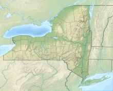 HWV Location of airport in New York / United States  HWV HWV (the United States) | |||||||||||||||
| Runways | |||||||||||||||
| |||||||||||||||
| Statistics (2005) | |||||||||||||||
| |||||||||||||||
Source: Federal Aviation Administration[1] | |||||||||||||||
Although most U.S. airports use the same three-letter location identifier for the FAA and IATA, Brookhaven Airport is assigned HWV by the FAA and WSH by the IATA. The airport's ICAO identifier is KHWV.[2]
History
Brookhaven Airport was constructed during World War II to provide logistical support for U.S. Army Air Corps operations. Known as Mastic Flight Strip, the title of the airport was transferred to New York State after the war. In 1961 the airport was acquired by the Town of Brookhaven. It was later renamed in honor of Dr. Frank Calabro, an important figure in the airport's development.
Facilities and aircraft
Brookhaven Airport covers an area of 795 acres (3.2 km²) which contains two runways:[1]
- Runway 6/24: 4,200 x 100 ft. (1,280 x 30 m), surface: asphalt
- Runway 15/33: 4,224 x 150 ft. (1,287 x 46 m), surface: asphalt/concrete
For 12-month period ending March 25, 2005, the airport had 135,100 aircraft operations, an average of 370 per day: 99% general aviation (135,000) and <1% military (100). There are 217 aircraft based at this airport: 92% single engine (200), 5% multi engine (10) and 3% gliders (5).[1]
Defunct Dowling College used to operate at Brookhaven Airport. Its School of Aviation offered bachelor's degrees in Aerospace Systems Technology and Aviation Management, and it participated in the FAA Air Traffic Control Collegiate Training Initiative (AT-CTI).
References
![]() This article incorporates public domain material from the Air Force Historical Research Agency website http://www.afhra.af.mil/.
This article incorporates public domain material from the Air Force Historical Research Agency website http://www.afhra.af.mil/.
- Shaw, Frederick J. (2004), Locating Air Force Base Sites History's Legacy, Air Force History and Museums Program, United States Air Force, Washington DC, 2004.
- FAA Airport Form 5010 for HWV PDF, retrieved 03/15/2007
- Great Circle Mapper: WSH / KHWV - Shirley, New York (Brookhaven Airport)
External links
- "Brookhaven General Aviation". Town of Brookhaven. Retrieved 22 August 2015.
- "New York State DOT Airport Diagram" (PDF).
- Resources for this airport:
- FAA airport information for HWV
- AirNav airport information for KHWV
- ASN accident history for WSH
- FlightAware airport information and live flight tracker
- NOAA/NWS weather observations: current, past three days
- SkyVector aeronautical chart, Terminal Procedures
This article about an airport in New York is a stub. You can help Wikipedia by expanding it. |
This article about a building or structure in New York is a stub. You can help Wikipedia by expanding it. |
Другой контент может иметь иную лицензию. Перед использованием материалов сайта WikiSort.org внимательно изучите правила лицензирования конкретных элементов наполнения сайта.
WikiSort.org - проект по пересортировке и дополнению контента Википедии