avia.wikisort.org - Aerodrome
Danbury Municipal Airport (IATA: DXR, ICAO: KDXR, FAA LID: DXR) is a public use general aviation and commercial airport located three miles (5 km) southwest of the central business district of Danbury, in Fairfield County, Connecticut, United States.[1] The airport opened in 1930. It is currently run by the City of Danbury under the management of Michael Safranek. It is included in the Federal Aviation Administration (FAA) National Plan of Integrated Airport Systems for 2017–2021, in which it is categorized as a regional reliever airport facility.[2]
Danbury Municipal Airport | |||||||||||||||
|---|---|---|---|---|---|---|---|---|---|---|---|---|---|---|---|
 | |||||||||||||||
| Summary | |||||||||||||||
| Airport type | Public | ||||||||||||||
| Owner | City of Danbury | ||||||||||||||
| Serves | Danbury, Connecticut | ||||||||||||||
| Location | Danbury, Connecticut | ||||||||||||||
| Hub for | Reliant Air and Eagle Air | ||||||||||||||
| Elevation AMSL | 458 ft / 140 m | ||||||||||||||
| Coordinates | 41°22′18″N 073°28′56″W | ||||||||||||||
| Website | DXR Website | ||||||||||||||
| Maps | |||||||||||||||
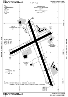 FAA airport diagram | |||||||||||||||
 DXR Location of airport in Connecticut/United States  DXR DXR (the United States) | |||||||||||||||
| Runways | |||||||||||||||
| |||||||||||||||
| Statistics (2015) | |||||||||||||||
| |||||||||||||||
Source: Federal Aviation Administration[1] | |||||||||||||||
The Reliant Air building burned down on the evening of September 12, 2007. The hangar was located on the northeast side of the airport.[3] It has since been rebuilt and Reliant Air continues in business.
History
In 1928, local pilots purchased a 60-acre tract near the Danbury Fairgrounds, known as Tucker's Field. This property was leased to the town in 1930 and became the Danbury Municipal Airport.[4]
Facilities and aircraft
Danbury Municipal Airport covers 248 acres (1.00 km2) and has two runways:[1]
- Runway 8/26: 4,422 x 150 ft (1,348 x 46 m), surface: asphalt
- Runway 17/35: 3,135 x 100 ft (956 x 30 m), surface: asphalt
The airport has three instrument approaches:
- Localizer Runway 8: decision height - 643 feet (196 m) AGL
- VOR or GPS-A: decision height - 902 feet (275 m) AGL
- GPS Runway 8: decision height - 802 feet (244 m) AGL
For the 12-month period ending December 31, 2008, the airport had 83,419 aircraft operations, an average of 228 per day: 56% local general aviation, 40% transient general aviation, 4% air taxi and <1% military. There were 265 aircraft based at this airport: 210 single engine, 48 multi-engine, 6 jet aircraft and 1 helicopter.[1]
The Connecticut Wing Civil Air Patrol 399th Composite Squadron (NER-CT-042) operates out of the airport. The hangar is located next to runway 35.[5]
Airlines and destinations
Passenger
This section needs to be updated. (January 2022) |
| Airlines | Destinations |
|---|---|
| Reliant Air | Seasonal charter: Martha's Vineyard, Nantucket[6] |
Accidents and incidents
- On October 16, 2011, a Cirrus SR22 crashed in a field near the airport. The aircraft's one occupant was killed in the crash.
- On January 22, 2013, a Cirrus SR22 landed on South Street in Danbury, The Cirrus CAP System was deployed and all three occupants were able to exit the aircraft safely without incident.
- On August 21, 2015, an Eclipse 500 (N120EA) veered off Runway 26, causing minor injuries to the occupants and badly damaging the aircraft.[7]
- On July 30, 2017, a Cessna 172 (N612DF) crashed in a dog park in Danbury shortly after taking off of Runway 26. Of the three passengers, two were injured, and one was killed from the crash.[8]
- On September 22, 2017, a Cessna 180 (N9624B) experienced a ground loop, causing the plane to partially cartwheel which severely damaged the engine and nose structure. The pilot experienced no injuries and the plane was subsequently repaired.[9]
See also
- Flying 20 Club, one of the oldest continuously active flying clubs
References
- FAA Airport Form 5010 for DXR PDF, effective 2007-07-05
- "List of NPIAS Airports" (PDF). FAA.gov. Federal Aviation Administration. 21 October 2016. Retrieved 27 November 2016.
- Kevin J. Czarzasty (2007-09-13). "Fire Destroys Hangar at Danbury Airport". FireFightingNews. Archived from the original on 2011-07-11. Retrieved 2009-11-14.
- "History". NynJctBotany.org. Retrieved April 13, 2018.
- http://399cap.org Civil Air Patrol 399th
- https://reliantair.com/nantucket-shuttle/ "Danbury to Nantucket"
- http://fox61.com/2015/08/21/small-plane-skids-off-the-runway-at-danbury-municipal-airport/ 8/21/15 Accident
- http://www.lohud.com/story/news/2017/07/30/3-injured-when-small-plane-crashes-near-danbury-airport/523755001/ 7/30/17 Accident
- http://www.newstimes.com/local/article/Plane-makes-rough-landing-at-Danbury-Airport-12220536.php#photo-14167479 9/22/17 Accident
External links
- https://www.danbury-ct.gov/government/departments/airport/
- FAA Airport Diagram (PDF), effective September 8, 2022
- Resources for this airport:
- FAA airport information for DXR
- AirNav airport information for KDXR
- ASN accident history for DXR
- FlightAware airport information and live flight tracker
- NOAA/NWS weather observations: current, past three days
- SkyVector aeronautical chart, Terminal Procedures
Другой контент может иметь иную лицензию. Перед использованием материалов сайта WikiSort.org внимательно изучите правила лицензирования конкретных элементов наполнения сайта.
WikiSort.org - проект по пересортировке и дополнению контента Википедии