avia.wikisort.org - Aerodrome
Diffa Airport (ICAO: DRZF) is an airport serving Diffa, a town in Niger.[3]
Diffa Airport | |||||||||||
|---|---|---|---|---|---|---|---|---|---|---|---|
| |||||||||||
| Summary | |||||||||||
| Airport type | Public | ||||||||||
| Owner | Government | ||||||||||
| Location | Diffa, Niger | ||||||||||
| Elevation AMSL | 994 ft / 303 m | ||||||||||
| Coordinates | 13°22′20″N 12°37′30″E | ||||||||||
| Map | |||||||||||
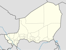 DRZF Location of the airport in Niger | |||||||||||
| Runways | |||||||||||
| |||||||||||
The airport is in the desert 6 kilometres (3.7 mi) north of Diffa. The runway has an additional 800 metres (2,600 ft) unpaved overrun on the east end.
Airlines and destinations
| Airlines | Destinations |
|---|---|
| Niger Airlines | Niamey |
See also
 Aviation portal
- Transport in Niger
- List of airports in Niger
References
- Airport information for Diffa Airport at Great Circle Mapper.
- Google Maps - Diffa Airfield
- "Attributions des départements de l'ANAC." Agence nationale de l'aviation civile du Niger. Retrieved on 9 Sept 2017.
External links
- OpenStreetMap - Diffa
- OurAirports - Diffa
- SkyVector - Diffa
- FallingRain - Diffa Airport
- Accident history for Diffa Airport at Aviation Safety Network
This Niger location article is a stub. You can help Wikipedia by expanding it. |
This article about an airport in Niger is a stub. You can help Wikipedia by expanding it. |
На других языках
- [en] Diffa Airport
[fr] Aérodrome de Diffa
@media all and (max-width:720px){body.skin-minerva .mw-parser-output *[class*="infobox"] table{display:table}body.skin-minerva .mw-parser-output *[class*="infobox"] caption{display:table-caption}}Текст в блоке "Читать" взят с сайта "Википедия" и доступен по лицензии Creative Commons Attribution-ShareAlike; в отдельных случаях могут действовать дополнительные условия.
Другой контент может иметь иную лицензию. Перед использованием материалов сайта WikiSort.org внимательно изучите правила лицензирования конкретных элементов наполнения сайта.
Другой контент может иметь иную лицензию. Перед использованием материалов сайта WikiSort.org внимательно изучите правила лицензирования конкретных элементов наполнения сайта.
2019-2026
WikiSort.org - проект по пересортировке и дополнению контента Википедии
WikiSort.org - проект по пересортировке и дополнению контента Википедии