avia.wikisort.org - Aerodrome
Dirkou Airport (ICAO: DRZD) is an airport serving the isolated Saharan outpost of Dirkou, Niger. It is 2 kilometres (1.2 mi) southwest of the city center. In early 2018 the airport saw extensive expansion during construction of a base for Central Intelligence Agency drone operations.[2][3]
Dirkou Airport | |||||||||||
|---|---|---|---|---|---|---|---|---|---|---|---|
 SkySat photo of a U-28A at the Dirkou Airport CIA annex in March, 2021 | |||||||||||
| |||||||||||
| Summary | |||||||||||
| Airport type | Public | ||||||||||
| Serves | Dirkou | ||||||||||
| Elevation AMSL | 1,273 ft / 388 m | ||||||||||
| Coordinates | 18°58′10″N 12°52′10″E | ||||||||||
| Map | |||||||||||
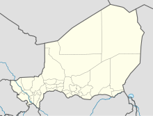 DRZD Location of the airport in Niger | |||||||||||
| Runways | |||||||||||
| |||||||||||
Source: Google Maps[1] | |||||||||||
See also
 Aviation portal
- Transport in Niger
- List of airports in Niger
References
- Google Maps - Dirkou
- The New York Times (September 10, 2018). "How a C.I.A. Drone Base Grew in Niger's Desert". YouTube. Archived from the original on 2021-12-15.
- Schmitt, Eric; Koettl, Christoph. "Remote C.I.A. Base in the Sahara Steadily Grows". The New York Times. Archived from the original on March 9, 2021.
External links
This Niger location article is a stub. You can help Wikipedia by expanding it. |
This article about an airport in Niger is a stub. You can help Wikipedia by expanding it. |
На других языках
- [en] Dirkou Airport
[fr] Aérodrome de Dirkou
@media all and (max-width:720px){body.skin-minerva .mw-parser-output *[class*="infobox"] table{display:table}body.skin-minerva .mw-parser-output *[class*="infobox"] caption{display:table-caption}}Текст в блоке "Читать" взят с сайта "Википедия" и доступен по лицензии Creative Commons Attribution-ShareAlike; в отдельных случаях могут действовать дополнительные условия.
Другой контент может иметь иную лицензию. Перед использованием материалов сайта WikiSort.org внимательно изучите правила лицензирования конкретных элементов наполнения сайта.
Другой контент может иметь иную лицензию. Перед использованием материалов сайта WikiSort.org внимательно изучите правила лицензирования конкретных элементов наполнения сайта.
2019-2025
WikiSort.org - проект по пересортировке и дополнению контента Википедии
WikiSort.org - проект по пересортировке и дополнению контента Википедии