avia.wikisort.org - Aerodrome
Gümüşhane Örenşar Airport (IATA: ?, ICAO: ?) (Turkish: Gümüşhane Örenşar Havalimanı) is a planned public airport at Örenşar village of Köse district in Gümüşhane Province, Turkey. [1] The airport will be located 64 km (40 mi) away from Gümüşhane city centre.
Gümüşhane Örenşar Airport Gümüşhane Örenşar Havalimanı | |||||||||||
|---|---|---|---|---|---|---|---|---|---|---|---|
| |||||||||||
| Summary | |||||||||||
| Airport type | Public/Civil | ||||||||||
| Owner | DHMI | ||||||||||
| Operator | State Airports Administration (Turkish: Devlet Hava Meydanları İşletmesi (DHMİ)) | ||||||||||
| Serves | Gümüşhane | ||||||||||
| Location | Örenşar | ||||||||||
| Elevation AMSL | 519 m / 1,704 ft | ||||||||||
| Coordinates | 40°15′25″N 39°48′35″E | ||||||||||
| Map | |||||||||||
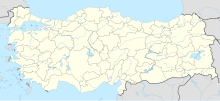
 Gümüşhane Örenşar Airport Location of airport in Turkey | |||||||||||
| Runways | |||||||||||
| |||||||||||
The Gümüşhane Örenşar Airport will be re-developed on its current STOLport location that was built back in 1995. The runway will be extended from 1,113 m × 30 m (3,652 ft × 98 ft) to 3,500 m × 45 m (11,483 ft × 148 ft) on 07/25 direction. Despite the finished feasibility plans, the tender to build the airport has not been issued yet.[2][3]
Airport is close to Örenşar, Salyazı, Bizgili, Gökçeköy, Yaylım, Bayrampaşa, Oylumdere, Çakıröz, Altıntaş, Özbeyli, Çatalçeşme, Kabaktepe, Eymür, Yuvacık, Çiftetaş, Çayıryolu, Pulur, Yenice, Kitre, Güneşli, Manas, Tomlacık, Beyçam, Kocayokuş, Karayaşmak, Övünce, Nazlıçayır, Güvercindere, Çalık, Çerçi villages, Gökçedere town, Demirözü and Köse district centers.
References
- "Google Maps". Google Maps. Retrieved 2022-05-06.
- "Gümüşhane Salyazı Havaalanı Ulaştırma Bakanlığı Planları Arasında". Gümüşhane Ekspres (in Turkish). 2012-12-17. Retrieved 2013-07-21.
- "Havacılık ve UzayTeknolojileri-Etüt Proje Aşamasında Olan Havalimanı Projeleri-Gümüşhane Salyazı Havalimanı" (PDF) (in Turkish). Ulaştırma, Denizcilik ve Haberleşme Bakanlığı. p. 22. Archived from the original (PDF) on 2013-08-10. Retrieved 2013-07-21.
External links
- Salyazı Havaalanı Ulaştırma Bakanlığı PlanlarıArasına Girdi at gumushane.gen.tr (in Turkish)
- Gümüşhane Havaalanı Projesi at ucuyorum.com (in Turkish)
- Köse Havaalanı İçin Teknik Heyet Gümüşhane'de at gumushane.gen.tr (in Turkish)
- Havaalanı için Teknik Heyet geldi at Gümüşhane Kuşakkaya (in Turkish)
На других языках
[de] Flughafen Gümüşhane-Bayburt
Der Flughafen Gümüşhane-Bayburt (auch Gümüşhane-Örenşar genannt) ist ein im Bau befindlicher türkischer Flughafen.[1] Die Entfernung zu den Zentren Gümüşhane und Bayburt beträgt 67 beziehungsweise 47 Kilometer. Die Eröffnung ist für das Jahr 2023 geplant.- [en] Gümüşhane-Bayburt Airport
Другой контент может иметь иную лицензию. Перед использованием материалов сайта WikiSort.org внимательно изучите правила лицензирования конкретных элементов наполнения сайта.
WikiSort.org - проект по пересортировке и дополнению контента Википедии