avia.wikisort.org - Aerodrome
Grove Hill Municipal Airport (FAA LID: 3A0) was a city-owned public-use airport located two nautical miles (3.7 km) southeast of the central business district of Grove Hill, a city in Clarke County, Alabama, United States.[1] According to the FAA's National Plan of Integrated Airport Systems for 2009–2013, it was categorized as a general aviation facility.[2] The airport has been permanently closed.
Grove Hill Municipal Airport | |||||||||||
|---|---|---|---|---|---|---|---|---|---|---|---|
 NAIP aerial image, 2006 | |||||||||||
| |||||||||||
| Summary | |||||||||||
| Airport type | Closed | ||||||||||
| Owner | City of Grove Hill | ||||||||||
| Serves | Grove Hill, Alabama | ||||||||||
| Elevation AMSL | 478 ft / 146 m | ||||||||||
| Coordinates | 31°41′22″N 087°45′41″W | ||||||||||
| Map | |||||||||||
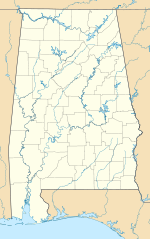 3A0 Location of airport in Alabama | |||||||||||
| Runways | |||||||||||
| |||||||||||
| Statistics (2010) | |||||||||||
| |||||||||||
Source: Federal Aviation Administration[1] | |||||||||||
Facilities and aircraft
Grove Hill Municipal Airport covers an area of 130 acres (53 ha) at an elevation of 478 feet (146 m) above mean sea level. It has one runway designated 13/31 with an asphalt surface measuring 2,704 by 75 feet (824 x 23 m).[1]
For the 12-month period ending February 23, 2010, the airport had 2,490 general aviation aircraft operations, an average of 207 per month. At that time there were 6 aircraft based at this airport: 83% single-engine and 17% multi-engine.[1]
References
- FAA Airport Form 5010 for 3A0 PDF. Federal Aviation Administration. Effective 3 June 2010.
- National Plan of Integrated Airport Systems for 2009–2013: Appendix A: Part 1 (PDF, 1.33 MB) Archived 2011-08-06 at the Wayback Machine. Federal Aviation Administration. Updated 15 October 2008.
External links
- Coastal Gateway Regional Economic Development Authority
- Aerial image as of 20 January 1992 from USGS The National Map
- Airfield photos for 3A0 from Civil Air Patrol
- Resources for this airport:
- FAA airport information for 3A0
- AirNav airport information for 3A0
- FlightAware airport information and live flight tracker
- SkyVector aeronautical chart for 3A0
Другой контент может иметь иную лицензию. Перед использованием материалов сайта WikiSort.org внимательно изучите правила лицензирования конкретных элементов наполнения сайта.
WikiSort.org - проект по пересортировке и дополнению контента Википедии