avia.wikisort.org - Aerodrome
Jeremiah Denton Airport (FAA LID: 4R9), formerly Dauphin Island Airport, is a county-owned public-use airport in Mobile County, Alabama, United States.[1] It is just northwest of the central business district of Dauphin Island,[1] a town located on a barrier island. The airport is on Mobile Bay, west of the Aloe Bay Channel.[2]
Jeremiah Denton Airport | |||||||||||
|---|---|---|---|---|---|---|---|---|---|---|---|
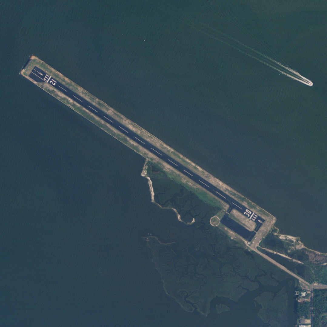 NAIP aerial image, 23 June 2006 | |||||||||||
| |||||||||||
| Summary | |||||||||||
| Airport type | Public | ||||||||||
| Owner | Mobile County | ||||||||||
| Serves | Dauphin Island, Alabama | ||||||||||
| Elevation AMSL | 5 ft / 2 m | ||||||||||
| Coordinates | 30°15′38″N 088°07′39″W | ||||||||||
| Runways | |||||||||||
| |||||||||||
| Statistics (2017) | |||||||||||
| |||||||||||
Source: Federal Aviation Administration[1] | |||||||||||
This airport is included in the FAA's National Plan of Integrated Airport Systems for 2011–2015[3] and 2009–2013,[4] both of which categorized it as a general aviation facility. In 2017 the airfield was closed for a time to test Navy drone operations. [5]
Facilities and aircraft
Dauphin Island Airport covers an area of 22 acres (9 ha) at an elevation of 5 feet (2 m) above mean sea level. It has one runway designated 12/30 with an asphalt surface measuring 3,000 by 80 feet (914 x 24 m). For the 12-month period ending May 18, 2010, the airport had 3,650 general aviation aircraft operations, an average of 10 per day.[1]
References
- FAA Airport Form 5010 for 4R9 PDF. Federal Aviation Administration. Effective 25 August 2011.
- "About the Island: Dauphin Island Airport". Dauphin Island Property. Archived from the original on 19 November 2008. Retrieved 27 July 2009.
- "2011–2015 NPIAS Report, Appendix A (PDF, 2.03 MB)" (PDF). 2011–2015 National Plan of Integrated Airport Systems. Federal Aviation Administration. 4 October 2010. Archived from the original (PDF) on 2012-09-27.
- "2009–2013 NPIAS Report, Appendix A: Part 1 (PDF, 1.33 MB)" (PDF). 2009–2013 National Plan of Integrated Airport Systems. Federal Aviation Administration. 15 October 2008. Archived from the original (PDF) on 2011-08-06.
- "Navy to use Dauphin Island for unmanned test flights". 30 March 2017.
External links
- Aerial image as of 15 February 1997 from USGS The National Map
- Birding areas at Dauphin Island Airport
- Resources for this airport:
- FAA airport information for 4R9
- AirNav airport information for 4R9
- FlightAware airport information and live flight tracker
- SkyVector aeronautical chart for 4R9
На других языках
- [en] Jeremiah Denton Airport
[ru] Дофин-Айленд (аэропорт)
Аэропорт Дофин-Айленд (англ. Dauphin Island Airport), (FAA LID: 4R9) — гражданский аэропорт, расположенный в северо-западной части центрального района города Дофин-Айленд (округ Мобил, Алабама, США). Аэропорт находится в собственности округа Мобил[1][3].Другой контент может иметь иную лицензию. Перед использованием материалов сайта WikiSort.org внимательно изучите правила лицензирования конкретных элементов наполнения сайта.
WikiSort.org - проект по пересортировке и дополнению контента Википедии