avia.wikisort.org - Aerodrome
Siple Dome (81°39′15″S 149°00′18″W) is an ice dome approximately 100 km wide and 100 km long, located 130 km east of Siple Coast in Antarctica. Charles Bentley and Robert Thomas established a "strain rosette" on this feature to determine ice movement in 1973–74. They referred to the feature as Siple Dome because of its proximity to Siple Coast.
Siple Dome Field Camp | |
|---|---|
Camp | |
 Siple Dome Field Camp in 2012 | |
 Siple Dome Field Camp | |
| Coordinates: 81°39′15″S 149°00′18″W | |
| Country | |
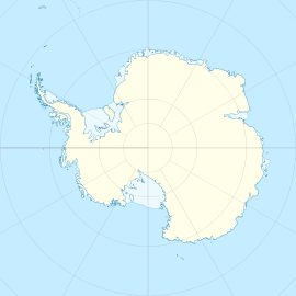
| Location in Antarctica | Siple Dome Marie Byrd Land Antarctica |
| Administered by | National Science Foundation |
| Established | 1996 |
| Elevation | 730 m (2,400 ft) |
| Population | |
| • Total | Up to 60 |
| Type | Seasonal |
Siple Dome ice core
The Siple Dome ice core project (79.468° S 112.086° W) was conducted by the United States National Science Foundation. The deepest ice was recovered in 1999 from 974 m, with an age of 97,600 years.[1]
It is best known for the poorly-explained steps in water isotopes during the deglacial, which are unique to this core and may indicate a rapid decrease in the surface elevation of the adjoining ice streams during the deglacial[2] and a record of atmospheric carbon dioxide.[3] The Chief Scientist was Kendrick Taylor.
Radar surveys of internal ice structure
In the 1990s a team from the University of Washington and St Olaf College surveyed the ice, measuring thickness and determining internal structure, [4] finding evidence for the operation of the Raymond Effect. They also found that the ice had a maximum thickness of around 1000 m.
In popular culture
- A documentary on climate change research associated with the Siple Dome ice core was produced by Nova: Warnings from the Ice, 1998. The documentary explains how reductions in Antarctic ice mass can raise sea level.
- Siple Dome is referenced in the song "Fall of Sipledome" by thrash metal band Testament (on their 1999 album The Gathering).
Climate
The climate is ice cap (Köppen: ET), as is most of the continent. Without marine moderation and a few hundred meters above sea level, it has one of the harshest winters on the continent outside the Antarctic plateaus. Unlike Alert, NU at slightly higher latitude and positive high averages during summer, in Siple Dome temperatures remain below freezing during the afternoon of the warmer months on average.[5][6]
| Climate data for Siple dome, elevation: 620 m or 2,030 ft, 1997-2011 normals and extremes | |||||||||||||
|---|---|---|---|---|---|---|---|---|---|---|---|---|---|
| Month | Jan | Feb | Mar | Apr | May | Jun | Jul | Aug | Sep | Oct | Nov | Dec | Year |
| Record high °C (°F) | 11.4 (52.5) |
7.1 (44.8) |
−4.6 (23.7) |
−4.6 (23.7) |
−4.9 (23.2) |
−5.9 (21.4) |
−8.6 (16.5) |
−8.8 (16.2) |
−5.6 (21.9) |
0.0 (32.0) |
3.1 (37.6) |
7.4 (45.3) |
11.4 (52.5) |
| Average high °C (°F) | −5.5 (22.1) |
−11.3 (11.7) |
−18.0 (−0.4) |
−22.5 (−8.5) |
−24.7 (−12.5) |
−23.5 (−10.3) |
−26.1 (−15.0) |
−28.9 (−20.0) |
−25.0 (−13.0) |
−18.1 (−0.6) |
−10.2 (13.6) |
−5.3 (22.5) |
−18.3 (−0.9) |
| Daily mean °C (°F) | −9.8 (14.4) |
−15.7 (3.7) |
−22.5 (−8.5) |
−26.6 (−15.9) |
−29.0 (−20.2) |
−27.6 (−17.7) |
−30.3 (−22.5) |
−32.9 (−27.2) |
−29.8 (−21.6) |
−23.6 (−10.5) |
−15.1 (4.8) |
−9.8 (14.4) |
−22.7 (−8.9) |
| Average low °C (°F) | −13.3 (8.1) |
−19.3 (−2.7) |
−26.4 (−15.5) |
−30.6 (−23.1) |
−33.3 (−27.9) |
−31.7 (−25.1) |
−34.4 (−29.9) |
−37.1 (−34.8) |
−33.9 (−29.0) |
−27.9 (−18.2) |
−18.7 (−1.7) |
−13.3 (8.1) |
−26.7 (−16.0) |
| Record low °C (°F) | −22.9 (−9.2) |
−33.9 (−29.0) |
−41.8 (−43.2) |
−49.9 (−57.8) |
−49.6 (−57.3) |
−56.6 (−69.9) |
−54.6 (−66.3) |
−59.4 (−74.9) |
−53.9 (−65.0) |
−44.8 (−48.6) |
−37.9 (−36.2) |
−21.9 (−7.4) |
−59.4 (−74.9) |
| Source: Climatebase.ru[6] | |||||||||||||
See also
Siple Dome Skiway | |||||||||||
|---|---|---|---|---|---|---|---|---|---|---|---|
 Siple Dome Field Camp | |||||||||||
| |||||||||||
| Summary | |||||||||||
| Airport type | government | ||||||||||
| Owner/Operator | US Antarctic Program | ||||||||||
| Location | Marie Byrd Land | ||||||||||
| Elevation AMSL | 1,994 ft / 607 m | ||||||||||
| Coordinates | 81°39′29″S 148°59′51″W | ||||||||||
| Map | |||||||||||
 Siple Dome Skiway Location of airfield in Antarctica | |||||||||||
| Runways | |||||||||||
| |||||||||||
- WAIS Divide
- List of Antarctic field camps
- Airports in Antarctica
Further reading
- Jinho Ahn, Edward J. Brook, Siple Dome ice reveals two modes of millennial CO2 change during the last ice age
- Pavel G. Talalay, Mechanical Ice Drilling Technology, PP 201– 202
References
- Brook, E. J., White, J. W., Schilla, A. S., Bender, M. L., Barnett, B., Severinghaus, J. P., ... & Steig, E. J. (2005). Timing of millennial-scale climate change at Siple Dome, West Antarctica, during the last glacial period. Quaternary Science Reviews, 24(12), 1333-1343.
- Taylor, K. C., White, J. W. C., Severinghaus, J. P., Brook, E. J., Mayewski, P. A., Alley, R. B., ... & Lamorey, G. W. (2004). Abrupt climate change around 22ka on the Siple Coast of Antarctica. Quaternary Science Reviews, 23(1), 7-15.
- Ahn, J., Wahlen, M., Deck, B. L., Brook, E. J., Mayewski, P. A., Taylor, K. C., & White, J. W. (2004). A record of atmospheric CO2 during the last 40,000 years from the Siple Dome, Antarctica ice core. Journal of Geophysical Research: Atmospheres, 109(D13)
- Nereson, N.A.; Raymond, C.F.; et al. (2000). "The accumulation pattern across Siple Dome, West Antarctica, inferred from radar-detected internal layers". Journal of Glaciology. 46 (152): 75–87. Bibcode:2000JGlac..46...75N. CiteSeerX 10.1.1.367.2532. doi:10.3189/172756500781833449. S2CID 18864009.
- "World Maps of Köppen-Geiger climate classification". koeppen-geiger.vu-wien.ac.at. Retrieved 2019-07-24.
- "Siple dome, Antarctica #89345". Climatebase.ru. Retrieved July 24, 2019.
![]() This article incorporates public domain material from the United States Geological Survey document: "Siple Dome". (content from the Geographic Names Information System)
This article incorporates public domain material from the United States Geological Survey document: "Siple Dome". (content from the Geographic Names Information System)

Antarctica | ||||||||
|---|---|---|---|---|---|---|---|---|
| Geography |
|  | ||||||
| History |
| |||||||
| Politics |
| |||||||
| Society |
| |||||||
| Famous explorers |
| |||||||
| ||||||||
Другой контент может иметь иную лицензию. Перед использованием материалов сайта WikiSort.org внимательно изучите правила лицензирования конкретных элементов наполнения сайта.
WikiSort.org - проект по пересортировке и дополнению контента Википедии