avia.wikisort.org - Aerodrome
Auxerre – Branches Aerodrome (French: Aérodrome d'Auxerre - Branches[2]) (IATA: AUF[4][5], ICAO: LFLA) is an airport serving Auxerre and Branches, both communes of the Yonne department[1] in the Bourgogne region of France. The airport is located 8.5 km (4.6 NM) northwest of Auxerre[1] and approximately 4 km (2.2 NM) southeast of Branches.[6]
Auxerre - Branches Aerodrome Aérodrome d'Auxerre - Branches | |||||||||||
|---|---|---|---|---|---|---|---|---|---|---|---|
| |||||||||||
| Summary | |||||||||||
| Airport type | Public | ||||||||||
| Operator | CCI de l'Yonne | ||||||||||
| Serves | Auxerre / Branches, Yonne, France | ||||||||||
| Elevation AMSL | 523 ft / 159 m | ||||||||||
| Coordinates | 47°50′47″N 003°29′48″E | ||||||||||
| Website | http://www.auxerre.aeroport.fr | ||||||||||
| Map | |||||||||||
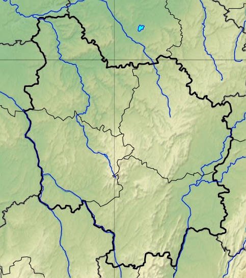 LFLA Location of airfield in Burgundy region Location of Burgundy region in France 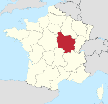 | |||||||||||
| Runways | |||||||||||
| |||||||||||
Facilities
The airport resides at an elevation of 523 feet (159 m) above mean sea level. It has one runway designated 01/19 with an asphalt surface measuring 1,650 by 30 metres (5,413 ft × 98 ft).[1]
Statistics
Annual passenger traffic at AUF airport.
See source Wikidata query.
References
- LFLA – Auxerre Branches. AIP from French Service d'information aéronautique, effective 16 June 2022.
- "Aérodrome d'Auxerre - Branches". Union des Aéroports Français. Archived from the original on 25 January 2010. Retrieved 12 May 2010.
- Airport information for LFLA from DAFIF (effective October 2006)
- Airport information for AUF at Great Circle Mapper. Source: DAFIF (effective October 2006).
- "Auxerre-Branches Airport (AUF / LFLA)". Aviation Safety Network. Retrieved 12 May 2010.
- "Aerial image with distances to airport from Auxerre and Branches". WikiMapia. Retrieved 12 May 2010.
External links
- (in French) Official Auxerre Airport website
- (in French) CCI de l'Yonne
- Aeronautical chart and airport information for LFLA at SkyVector
На других языках
[de] Flugplatz Auxerre-Branches
Das Aérodrome d’Auxerre-Branches bzw. der Aéroport d’Auxerre ist ein Flugplatz der Allgemeinen Luftfahrt in der französischen Region Bourgogne-Franche-Comté. Er liegt im Département Yonne knapp neun km nordwestlich von Auxerre auf dem Gebiet der Gemeinden Branches, Charbuy und Appoigny.- [en] Auxerre – Branches Aerodrome
[fr] Aéroport d'Auxerre - Branches
Propriété d'un syndicat mixte composé de la communauté d'agglomération de l'auxerrois, du Département de l'Yonne et de la Région Bourgogne-Franche-Comté depuis les lois de décentralisation, l'aéroport a été géré jusqu'au 5 février 2016 par la Chambre de Commerce et d'Industrie de l'Yonne. La délégation de service public a ensuite été confiée à la société SNC-Lavalin Aéroports dont les actifs ont été repris par EDEIS "l'allié des territoires" en 2017. L’aéroport d’Auxerre - Branches (code IATA : AUF • code OACI : LFLA) est un aéroport ouvert à la circulation aérienne publique (CAP)[1] situé sur les communes de Branches, Charbuy et Appoigny, à 8,5 km au nord-ouest d’Auxerre dans l’Yonne (région Bourgogne-Franche-Comté, France).Текст в блоке "Читать" взят с сайта "Википедия" и доступен по лицензии Creative Commons Attribution-ShareAlike; в отдельных случаях могут действовать дополнительные условия.
Другой контент может иметь иную лицензию. Перед использованием материалов сайта WikiSort.org внимательно изучите правила лицензирования конкретных элементов наполнения сайта.
Другой контент может иметь иную лицензию. Перед использованием материалов сайта WikiSort.org внимательно изучите правила лицензирования конкретных элементов наполнения сайта.
2019-2025
WikiSort.org - проект по пересортировке и дополнению контента Википедии
WikiSort.org - проект по пересортировке и дополнению контента Википедии