avia.wikisort.org - Aerodrome
Bourg – Ceyzériat Airport (French: Aéroport de Bourg - Ceyzériat) (ICAO: LFHS) is an airport located 5 km (3 NM) east of Bourg-en-Bresse[1] and northwest of Ceyzériat, both communes of the Ain department in the Rhône-Alpes region of France.
Bourg - Ceyzériat Airport Aéroport de Bourg - Ceyzériat | |||||||||||||||
|---|---|---|---|---|---|---|---|---|---|---|---|---|---|---|---|
 | |||||||||||||||
| Summary | |||||||||||||||
| Airport type | Public | ||||||||||||||
| Serves | Bourg-en-Bresse, France | ||||||||||||||
| Location | Ceyzériat, France | ||||||||||||||
| Elevation AMSL | 857 ft / 261 m | ||||||||||||||
| Coordinates | 46°12′20″N 005°17′30″E | ||||||||||||||
| Map | |||||||||||||||
 LFHS Location of airport in Ain department Location of Ain department in France 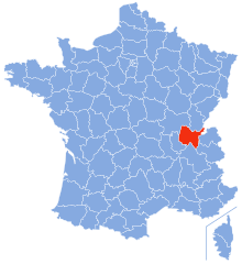 | |||||||||||||||
| Runways | |||||||||||||||
| |||||||||||||||
Source: AIP France[1] | |||||||||||||||
Facilities
The airport resides at an elevation of 857 feet (261 m) above mean sea level. It has one asphalt paved runway designated 18/36 measuring 1,139 by 30 metres (3,737 ft × 98 ft) and a parallel grass runway measuring 735 by 80 metres (2,411 ft × 262 ft).[1]
The airport is open 24 hours and offers Pilot Controlled Lighting for Night VFR flights.
It is walking distance from Bourg-en-Bresse Jasseron motorway station which offers a restaurant and hotel.
Airlines and destinations
There is no scheduled commercial air service at this time.
References
- LFHS – BOURG CEYZÉRIAT. AIP from French Service d'information aéronautique, effective 19 May 2022.
External links
- Aéro-club de Bourg-en-Bresse
- Accident history for LFHS at Aviation Safety Network
This French airport-related article is a stub. You can help Wikipedia by expanding it. |
На других языках
- [en] Bourg – Ceyzériat Airport
[fr] Aérodrome de Bourg - Ceyzériat
@media all and (max-width:720px){body.skin-minerva .mw-parser-output *[class*="infobox"] table{display:table}body.skin-minerva .mw-parser-output *[class*="infobox"] caption{display:table-caption}}Другой контент может иметь иную лицензию. Перед использованием материалов сайта WikiSort.org внимательно изучите правила лицензирования конкретных элементов наполнения сайта.
WikiSort.org - проект по пересортировке и дополнению контента Википедии