avia.wikisort.org - Aerodrome
Bancasi Airport (Cebuano: Tugpahanan sa Bancasi; Butuanon: Tugpahanan hong Bancasi; Filipino: Paliparan ng Bancasi; IATA: BXU, ICAO: RPME), also known as Butuan Airport, is the airport serving the general area of Butuan and Agusan del Norte. It is the only airport in Agusan del Norte and the largest in Caraga. The airport is classified as an International Airport by the Civil Aviation Authority of the Philippines (CAAP), a body of the Department of Transportation (DOTr) that is responsible for the operations of not only this airport but of all the other airports in the Philippines, except the major international airports.
Bancasi Airport Tugpahanan sa Bancasi Tugpahanan hong Bancasi Paliparan ng Bancasi | |||||||||||
|---|---|---|---|---|---|---|---|---|---|---|---|
 | |||||||||||
| Summary | |||||||||||
| Airport type | Public | ||||||||||
| Operator | Civil Aviation Authority of the Philippines | ||||||||||
| Serves | Butuan | ||||||||||
| Location | Bancasi, Butuan, Philippines | ||||||||||
| Elevation AMSL | 43 m / 141 ft | ||||||||||
| Coordinates | 8°57′5″N 125°28′41″E | ||||||||||
| Website | butuanbancasiairport | ||||||||||
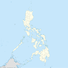
| Map | |||||||||||
 BXU/RPME Location in the Philippines | |||||||||||
| Runways | |||||||||||
| |||||||||||
| Statistics (2021) | |||||||||||
| |||||||||||
Source: Statistics from eFOI[1] | |||||||||||
Improvement projects
The Department of Transport and Communications (DOTC) announced that the airport would receive Php 45.5 million pesos in subsidy for expansion of the apron, improvement and expansion of vehicular parking area, construction of drainage system, and construction of concrete hollow block fence, with bidding scheduled to open to contractors on July 5, 2012.[2]
Airlines and destinations
| Airlines | Destinations |
|---|---|
| Cebgo | Cebu |
| Cebu Pacific | Cebu, Manila |
| PAL Express | Cebu, Manila |
Accidents and incidents
- On October 26, 2007, Philippine Airlines Flight 475 from Manila, operated by an Airbus A320-200 registered as RP-C3224, overshot the runway of Butuan Airport after landing. Nineteen injuries were reported.[3]
- On February 15, 2014, Cebu Pacific Flight 220, an Airbus A319-100 registered as RP-C3195, went off the runway of the airport on a flight to Mactan–Cebu when the nose gear and left main gear departed the paved surface of the runway during a 180-degree backtrack. 105 passengers were on board. No injuries were reported whatsoever.[4]
See also
References
- Civil Aviation Authority of the Philippines - Aerodrome Development & Management Service (15 April 2018). "Passenger Statistics Philippines". Republic of the Philippines - Freedom of Information Portal. Retrieved 27 April 2019.
- "Airports Rehab up for Bidding | the Manila Bulletin Newspaper Online". Manila Bulletin. Archived from the original on 2012-06-23. Retrieved 2012-06-19.
- "Some hurt as PAL plane misses Butuan runway". GMA News. Oct 26, 2007. Retrieved Feb 17, 2014.
- "Cebu Pacific Airbus A319 at Butuan on Feb 15th 2014, runway excursion during backtrack". www.aeroinside.com. Retrieved 2021-01-08.
На других языках
[de] Bancasi Airport
Der Bancasi Airport (Filipino Paliparan ng Bancasi, Cebuano Tugpahanan sa Bancasi) ist der Flughafen von Butuan City auf Mindanao in den Philippinen und befindet sich im Ortsteil Bancasi, wonach er benannt ist. Er liegt etwa 7 Kilometer vom Stadtzentrum entfernt direkt an der in Richtung Cagayan de Oro führenden Fernstraße. Es ist der einzige Flughafen der Provinz Agusan del Norte und der größte Flughafen in der Region Caraga.- [en] Bancasi Airport
[es] Aeropuerto de Bancasi
El Aeropuerto de Bancasi[1][2] (en tagalo: Paliparan ng Bancasi; en cebuano: Tugpahanan sa Bancasi) (IATA: BXU, ICAO: RPME) también conocido como Aeropuerto de Butuan; es un aeropuerto que sirve el área general de la ciudad de Butuan,[3] ubicada en la provincia de Agusan del Norte en Filipinas.[4][5] Es el único aeropuerto en la provincia y el más grande en la región de Caraga . El aeropuerto está clasificado como aeropuerto línea troncal o un aeropuerto comercial principal, por la Oficina de Transporte Aéreo , un organismo del Departamento de Transportes y Comunicaciones que se encarga de las operaciones no solo de este aeropuerto , sino también de todos los otros aeropuertos en Filipinas con excepción de los principales aeropuertos internacionales.[it] Aeroporto di Butuan
L'aeroporto di Butuan[1] (tagallo: Paliparan ng Butuan) (IATA: BXU, ICAO: RPME), definito come principale di classe 1 dalle autorità dell'aviazione civile filippina,[2] è un aeroporto filippino situato nella parte settentrionale dell'isola di Mindanao nella regione di Caraga, nella provincia di Agusan del Norte, a circa 7 chilometri a ovest della città di Butuan. La struttura è dotata di una pista di asfalto lunga 1966 m, l'altitudine è di 43 m, l'orientamento della pista è RWY 12-30.Другой контент может иметь иную лицензию. Перед использованием материалов сайта WikiSort.org внимательно изучите правила лицензирования конкретных элементов наполнения сайта.
WikiSort.org - проект по пересортировке и дополнению контента Википедии