avia.wikisort.org - Aerodrome
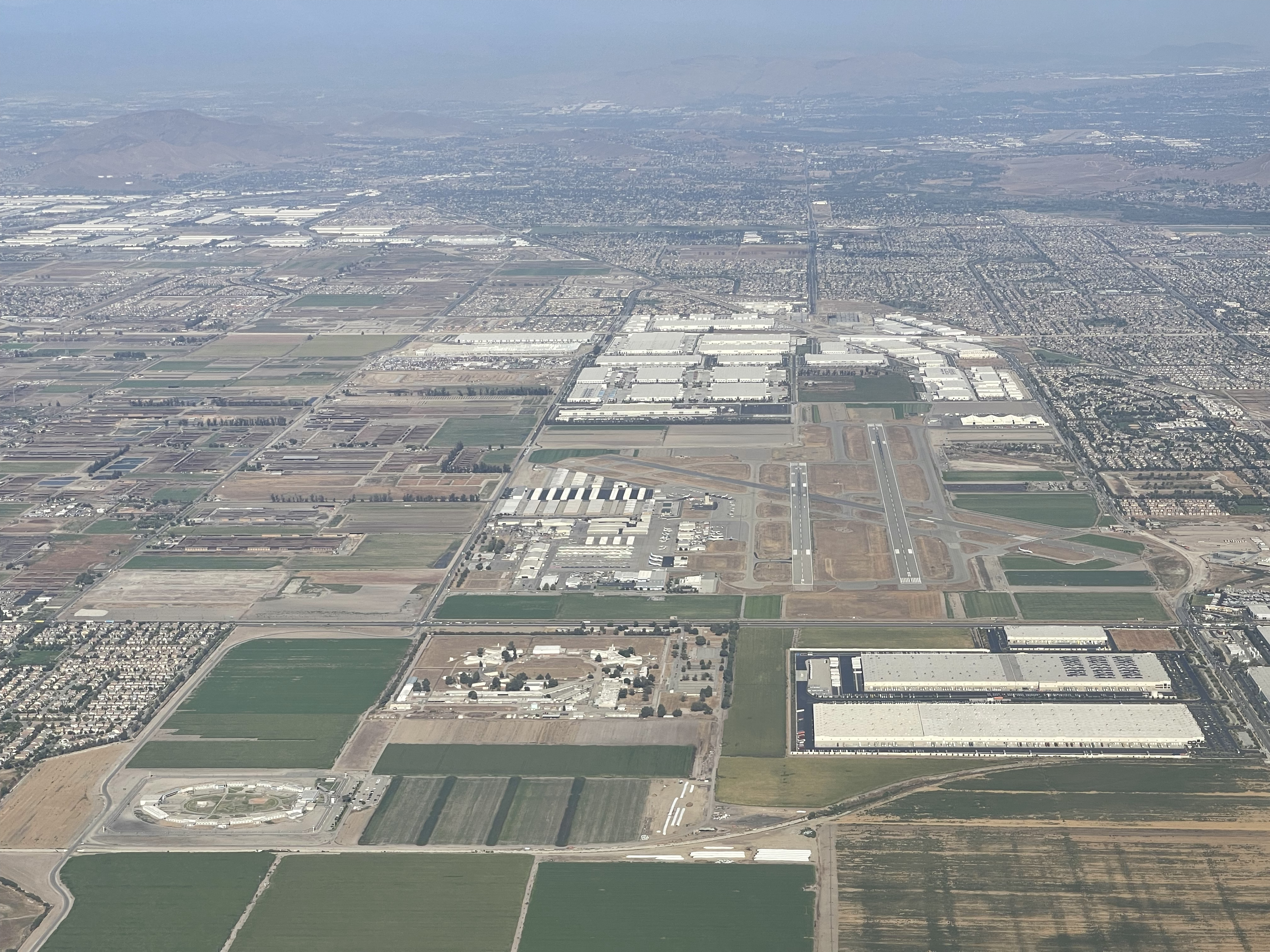
Chino Airport (IATA: CNO, ICAO: KCNO, FAA LID: CNO) is a county-owned airport about three miles southeast of Chino, in San Bernardino County, California, United States.[1] The Federal Aviation Administration's National Plan of Integrated Airport Systems for 2007–2011 classified it as a reliever airport,[2] due to its proximity to the Ontario International Airport and the John Wayne Airport (in Orange County).[3]
Chino Airport | |||||||||||||||||||
|---|---|---|---|---|---|---|---|---|---|---|---|---|---|---|---|---|---|---|---|
 | |||||||||||||||||||
| Summary | |||||||||||||||||||
| Airport type | Public | ||||||||||||||||||
| Owner | County of San Bernardino | ||||||||||||||||||
| Location | Chino, California | ||||||||||||||||||
| Elevation AMSL | 650 ft / 198 m | ||||||||||||||||||
| Coordinates | 33°58′29″N 117°38′12″W | ||||||||||||||||||
| Website | cms.sbcounty.gov | ||||||||||||||||||
| Runways | |||||||||||||||||||
| |||||||||||||||||||
| Statistics (2006) | |||||||||||||||||||
| |||||||||||||||||||
Source: Federal Aviation Administration[1] | |||||||||||||||||||
History
Cal-Aero Academy was an independent flying school at Chino Airport when World War II started. The U.S. Army Air Forces contracted with the school to provide basic and primary flight training for Army Air Cadets.[4] During the war, Cal-Aero operated the training base with Stearmans and BT-13s. The name "Cal-Aero" is preserved at the airport and it can be seen on several buildings.
Starting in early 1945, training aircraft surplused by the cessation of pilot training programs, and post-war, hundreds of combat aircraft were flown into Chino for disposal. This agricultural area was employed as a vast parking lot for warplanes. Soon, the entire area was filled with everything from T-6s to B-24 Liberators. Most planes met an undignified end in portable smelters which were brought there to melt down the warplanes into aluminum ingots.
During the mid-1960s, the field was used as the location setting for the TV series 12 O'Clock High, as the fictitious Archbury Army Air Field, which was home base to the (equally fictitious) 918th Bomb Group. The airfield itself and a number of World War II-era buildings were used for exterior shots.
Chino Airport is the home of two aircraft museums, the Planes of Fame and the Yanks Air Museum, and the airport is one of the centers of aircraft restoration and preservation with several different companies that do this work at the airport.
Accidents and incidents
On 13 June 2013, a private jet crashed into an empty office building near a hangar. Maintenance workers were testing the jet engines when the plane jumped over the chocks and the workers lost control. Since the building was empty, no one was seriously hurt, but the jet was destroyed.[5]
Facilities
Chino Airport covers 1,097 acres (444 ha) and has three asphalt runways:[1]
- 3/21: 4,919 x 150 ft (1,499 x 46 m)
- 8L/26R: 4,858 x 150 ft (1,481 x 46 m)
- 8R/26L: 7,000 x 150 ft (2,134 x 46 m)
General aviation
In the year ending March 27, 2009 the airport had 173,193 aircraft operations, average 461 per day: 99% general aviation and <1% military. 947 aircraft are based at the airport: 77 percent single-engine, 18 percent multi-engine, four percent jet, and one percent helicopter.[1]
FBOs:
Airport businesses
- M.I. AIR Aviation Education[8] – flight school
- Dubois Flight School[9]
- AIA Flight School[10]
- Mach One Air Charters[11] – jet charter provider with multiple FAA violations for unsafe operations[12][13]
See also
References
Notes
- FAA Airport Form 5010 for CNO PDF, effective 2007-10-25
- FAA National Plan of Integrated Airport Systems: 2007-2011
- Chino Airport Archived 2007-11-24 at the Wayback Machine at San Bernardino County Department of Airports
- Associated Press, “Cal-Aero Will Become Primary Training School”, ‘’The San Bernardino Daily Sun’’, San Bernardino, California, Wednesday 31 May 1944, Volume 50, page 10.
- Ezzeddine, Tena (14 June 2013). "Jet Slams Into Empty Offices at Chino Airport". NBC 7 San Diego. Retrieved 14 June 2013.
- Encore Jet Center
- Threshold Aviation Group
- M.I. AIR Aviation Education
- Dubois Flight School
- AIA Flight School
- Mach One Air Charters
- Transcript of FAA Action Against Chino Charter Company Mach One Air Charters
- FAA Docket 2015-0643 FAA vs Mach One Air Charters, Dan Hill
Bibliography
![]() This article incorporates public domain material from the Air Force Historical Research Agency website http://www.afhra.af.mil/.
This article incorporates public domain material from the Air Force Historical Research Agency website http://www.afhra.af.mil/.
- Manning, Thomas A. (2005), History of Air Education and Training Command, 1942–2002. Office of History and Research, Headquarters, AETC, Randolph AFB, Texas OCLC 71006954, 29991467
- Shaw, Frederick J. (2004), Locating Air Force Base Sites, History’s Legacy, Air Force History and Museums Program, United States Air Force, Washington DC. OCLC 57007862, 1050653629
External links
- San Bernardino County Department of Airports
- The History of Cal Aero Field
- FAA Airport Diagram (PDF), effective May 19, 2022
- Resources for this airport:
- FAA airport information for CNO
- AirNav airport information for KCNO
- ASN accident history for CNO
- FlightAware airport information and live flight tracker
- NOAA/NWS weather observations: current, past three days
- SkyVector aeronautical chart, Terminal Procedures
Airports in the Inland Empire | ||
|---|---|---|
| Commercial airports | 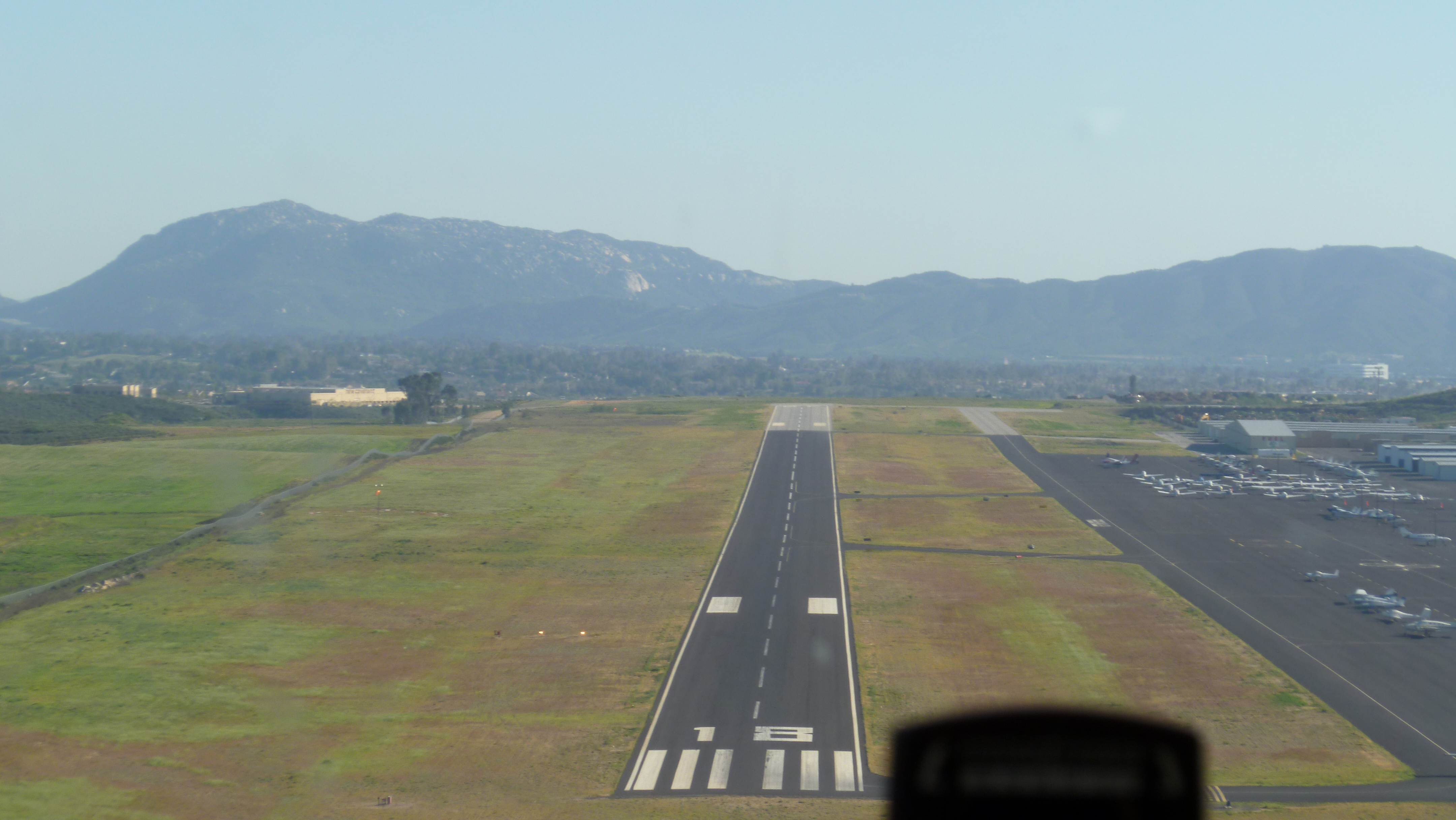 | |
| Towered general aviation airports | ||
| Non-towered general aviation airports | ||
| Military airports |
| |
| Defunct airports |
| |
| Flying Training |
|  | ||||
|---|---|---|---|---|---|---|
| Technical Training |
| |||||
Другой контент может иметь иную лицензию. Перед использованием материалов сайта WikiSort.org внимательно изучите правила лицензирования конкретных элементов наполнения сайта.
WikiSort.org - проект по пересортировке и дополнению контента Википедии