avia.wikisort.org - Aerodrome
Cobar Airport (IATA: CAZ, ICAO: YCBA) is an airport located 3 nautical miles (5.6 km; 3.5 mi) southwest[1] of Cobar, a town in the Australian state of New South Wales.
Cobar Airport | |||||||||||||||
|---|---|---|---|---|---|---|---|---|---|---|---|---|---|---|---|
 Aerial image, 6 March 2009 | |||||||||||||||
| |||||||||||||||
| Summary | |||||||||||||||
| Airport type | Public | ||||||||||||||
| Operator | Cobar Shire Council | ||||||||||||||
| Serves | Cobar, New South Wales, Australia | ||||||||||||||
| Elevation AMSL | 724 ft / 221 m | ||||||||||||||
| Coordinates | 31°32′18″S 145°47′36″E | ||||||||||||||
| Map | |||||||||||||||
YCBA Location in New South Wales | |||||||||||||||
| Runways | |||||||||||||||
| |||||||||||||||
Sources: Enroute Supplement Australia from Airservices Australia[1] | |||||||||||||||
Facilities
The airport is 724 ft (221 m) above mean sea level.[1] It has two runways: 05/23 with an asphalt surface measuring 1,519 by 30 metres (4,984 ft × 98 ft) and 17/35 with a clay surface measuring 1,221 by 30 metres (4,006 ft × 98 ft).[1]
Airlines and destinations
| Airlines | Destinations |
|---|---|
| FlyPelican[2] | Dubbo, Sydney |
See also
Gallery
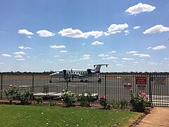 Beechcraft 1900D of Air Link parked on the apron at Cobar airport
 Cobar airport terminal building


References
- YCBA – COBAR (PDF). AIP En Route Supplement from Airservices Australia, effective 2022-03-24
- Liu, Jim. "FlyPelican adds Cobar service from late-Sep 2019". Routesonline. Retrieved 2 October 2019.
External links
- Accident history for CAZ at Aviation Safety Network
This New South Wales airport related article is a stub. You can help Wikipedia by expanding it. |
Текст в блоке "Читать" взят с сайта "Википедия" и доступен по лицензии Creative Commons Attribution-ShareAlike; в отдельных случаях могут действовать дополнительные условия.
Другой контент может иметь иную лицензию. Перед использованием материалов сайта WikiSort.org внимательно изучите правила лицензирования конкретных элементов наполнения сайта.
Другой контент может иметь иную лицензию. Перед использованием материалов сайта WikiSort.org внимательно изучите правила лицензирования конкретных элементов наполнения сайта.
2019-2026
WikiSort.org - проект по пересортировке и дополнению контента Википедии
WikiSort.org - проект по пересортировке и дополнению контента Википедии