avia.wikisort.org - Aerodrome
Grosseto Airport (Italian: Aeroporto di Grosseto) (IATA: GRS, ICAO: LIRS)[2] is an airport in central Italy, located 3 km (1.6 NM) west of Grosseto in the Italian region of Tuscany.
Grosseto Airport Aeroporto di Grosseto
 | |||||||||||||||
|---|---|---|---|---|---|---|---|---|---|---|---|---|---|---|---|
 | |||||||||||||||
| Summary | |||||||||||||||
| Airport type | Military / Public | ||||||||||||||
| Operator | Aeronautica Militare / Società di Esercizio dell'Aeroporto della Maremma S.p.A. (SEAM) | ||||||||||||||
| Serves | Grosseto, Italy | ||||||||||||||
| Elevation AMSL | 15 ft / 5 m | ||||||||||||||
| Coordinates | 42°45′35″N 011°04′18″E | ||||||||||||||
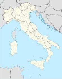
| Map | |||||||||||||||
 Grosseto Location of air base in Italy | |||||||||||||||
| Runways | |||||||||||||||
| |||||||||||||||
| Statistics (2012) | |||||||||||||||
| |||||||||||||||
Source: Statistics from Assaeroporti [1] | |||||||||||||||
Although it is classified as a "joint use" facility, Grosseto Airport is primarily an Italian Air Force (Aeronautica Militare) Base, home of the 4th Stormo, equipped with the Eurofighter Typhoon. However, the facility is used as a commercial airport by civilian charter flights and private aircraft.
History
During World War II the airfield, referred to as "Grosetta Main", was used by the United States Army Air Forces' Twelfth Air Force. The 86th Fighter Group flew P-47 Thunderbolts from the field between 17 September and 6 November 1944. Later, the 57th Fighter Group, used the airfield from 24 September 1944 to 29 April 1945, and later between 7 May and 15 July 1945, also flying combat operations with P-47s.[3][4] The 47th Bomb Group, and its four squadrons, the 84th, 85th, 86th, and 97th, using A-20 and A-26 Attack aircraft also used the airfield, mostly flying night intruder missions, from 11 December 1944 to 23 June 1945.[5]
In the fifties, expansion and modernization works were carried out on the entire airport infrastructure, which then led to the resumption of military activities and the inauguration of the first civil flights: always in that period, starting from 1959 the airport became the final seat of the 4th Wing (aerobrigata founded in 1931 at the Udine-Campoformido airport), while on 1 June 1961 the 9th Fighter Group of Italian Air Force.
Facilities
The airport resides at an elevation of 15 feet (5 m) above mean sea level. It has two asphalt paved runways: 03L/21R measuring 2,994 by 45 metres (9,823 ft × 148 ft) and 03R/21L measuring 2,356 by 24 metres (7,730 ft × 79 ft).[6]
Airlines and destinations
Effective 30 August 2018, there are no regular passenger flights to/from Grosseto Airport. Before its subsequent bankruptcy, SkyWork Airlines operated flights to Bern, sometimes via Elba, as well as London City Airport via Bern.
Statistics
References
- Associazione Italiana Gestori Aeroportuali[permanent dead link]
- "Aeroporto di Grosseto". Aeroporto di Grosseto (in Italian). Retrieved 2022-04-24.
-
 This article incorporates public domain material from the Air Force Historical Research Agency website http://www.afhra.af.mil/.
 - Maurer, Maurer. Air Force Combat Units of World War II. Maxwell AFB, Alabama: Office of Air Force History, 1983. ISBN 0-89201-092-4.
- 47thbombgroup.org
- Airport information for LIRS from DAFIF (effective October 2006)
External links
- Official site (English)
- Current weather for LIRS at NOAA/NWS
- Accident history for GRS at Aviation Safety Network
На других языках
[de] Militärflugplatz Grosseto
Der Militärflugplatz Grosseto liegt in der mittelitalienischen Region Toskana, rund zwei Kilometer westlich der Provinzhauptstadt Grosseto. Er ist eingeschränkt auch für den zivilen Luftverkehr geöffnet. Aus diesem Grund wird er auch als Aeroporto di Grosseto bezeichnet oder nach seiner Lage in der Maremma Aeroporto della Maremma genannt.- [en] Grosseto Airport
[fr] Aérodrome et base aérienne de Grosseto
@media all and (max-width:720px){body.skin-minerva .mw-parser-output *[class*="infobox"] table{display:table}body.skin-minerva .mw-parser-output *[class*="infobox"] caption{display:table-caption}}[it] Aeroporto di Grosseto
L'Aeroporto di Grosseto (Aeroporto della Maremma "Corrado Baccarini") è lo scalo della città toscana di Grosseto. L'aeroporto si trova a ovest della città; l'accesso allo scalo civile è situato a circa 2 km dal centro storico, mentre l'accesso alla Base Militare "4º Stormo Caccia Intercettori" avviene dalla via Castiglionese nella immediata periferia della città.Другой контент может иметь иную лицензию. Перед использованием материалов сайта WikiSort.org внимательно изучите правила лицензирования конкретных элементов наполнения сайта.
WikiSort.org - проект по пересортировке и дополнению контента Википедии