avia.wikisort.org - Aerodrome
Mbarara Airport (IATA: MBQ, ICAO: HUMA) is a civilian airport that serves the town of Mbarara in Ankole sub-region, Uganda. It is one of 12 upcountry airports administered by the Civil Aviation Authority of Uganda.[3] The airport was originally named Nyakisharara Airport.
Mbarara Airport Nyakisharara International Airport | |||||||||||
|---|---|---|---|---|---|---|---|---|---|---|---|
| |||||||||||
| Summary | |||||||||||
| Airport type | Public | ||||||||||
| Owner | Civil Aviation Authority of Uganda | ||||||||||
| Serves | Mbarara, Uganda | ||||||||||
| Elevation AMSL | 4,600 ft / 1,402 m | ||||||||||
| Coordinates | 00°33′18″S 30°36′00″E | ||||||||||
| Map | |||||||||||
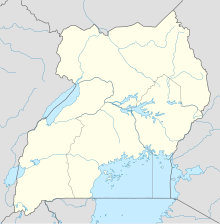 MBQ Location of Mbarara Airport in Uganda | |||||||||||
| Runways | |||||||||||
| |||||||||||
The airport is approximately 9 kilometres (5.6 mi) north-west of Mbarara, on the road to Bwizibwera and Ibanda.[1]
The runway length includes gravelled overruns of 190 and 85 metres (623 and 279 ft) on the east and west ends respectively.
See also
 Uganda portal
 Aviation portal
- List of airports in Uganda
- Transport in Uganda
References
- "Mbarara Airport". Google Maps. Google. Retrieved 11 June 2018.
- Airport information for Mbarara Airport at Great Circle Mapper.
- Mbarara Airport Administered by Uganda's CAA
External links
- OpenStreetMap - Mbarara Airport
- SkyVector - Mbarara Airport
- OurAirports - Mbarara Airport
- Uganda Civil Aviation Authority Homepage
- Accident history for Mbarara Airport at Aviation Safety Network
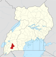
Capital: Mbarara | ||
| Counties and sub-counties |
|  |
| Towns and villages |
| |
| Economy |
| |
| Notable landmarks |
| |
| Transport |
| |
| Health |
| |
| Education |
| |
| Notable people |
| |
Текст в блоке "Читать" взят с сайта "Википедия" и доступен по лицензии Creative Commons Attribution-ShareAlike; в отдельных случаях могут действовать дополнительные условия.
Другой контент может иметь иную лицензию. Перед использованием материалов сайта WikiSort.org внимательно изучите правила лицензирования конкретных элементов наполнения сайта.
Другой контент может иметь иную лицензию. Перед использованием материалов сайта WikiSort.org внимательно изучите правила лицензирования конкретных элементов наполнения сайта.
2019-2026
WikiSort.org - проект по пересортировке и дополнению контента Википедии
WikiSort.org - проект по пересортировке и дополнению контента Википедии