avia.wikisort.org - Aerodrome
North Caicos Airport (IATA: NCA, ICAO: MBNC) is an airport serving North Caicos,[1] the second largest of the Turks and Caicos Islands.
North Caicos Airport | |||||||||||
|---|---|---|---|---|---|---|---|---|---|---|---|
| |||||||||||
| Summary | |||||||||||
| Airport type | Public | ||||||||||
| Location | North Caicos, Turks and Caicos Islands | ||||||||||
| Elevation AMSL | 10 ft / 3 m | ||||||||||
| Coordinates | 21°55′03″N 071°56′22″W | ||||||||||
| Map | |||||||||||
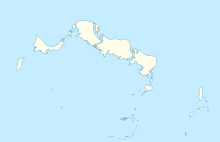 MBNC Location in North Caicos | |||||||||||
| Runways | |||||||||||
| |||||||||||
Facilities
The airport is at an elevation of 10 ft (3 m) above mean sea level. It has one runway designated 08/26 with an asphalt surface measuring 1,294 m × 23 m (4,245 ft × 75 ft).[1]
References
- "Airport information for MBNC". World Aero Data. Archived from the original on 5 March 2019.
{{cite web}}: CS1 maint: unfit URL (link) Data current as of October 2006. - Airport information for NCA at Great Circle Mapper. Source: DAFIF (effective October 2006).
External links
- Accident history for NCA at Aviation Safety Network
This article about a Caribbean airport is a stub. You can help Wikipedia by expanding it. |
This Turks and Caicos Islands location article is a stub. You can help Wikipedia by expanding it. |
На других языках
[de] North Caicos Airport
Der North Caicos Airport, auch North Caicos International (ICAO-Code: MBNC, IATA-Code: NCA), auf der Insel North Caicos ist ein nationaler Flughafen der Turks- und Caicosinseln. Er wird von der Turks & Caicos Islands Airports Authority (TCIAA) betrieben.- [en] North Caicos Airport
Текст в блоке "Читать" взят с сайта "Википедия" и доступен по лицензии Creative Commons Attribution-ShareAlike; в отдельных случаях могут действовать дополнительные условия.
Другой контент может иметь иную лицензию. Перед использованием материалов сайта WikiSort.org внимательно изучите правила лицензирования конкретных элементов наполнения сайта.
Другой контент может иметь иную лицензию. Перед использованием материалов сайта WikiSort.org внимательно изучите правила лицензирования конкретных элементов наполнения сайта.
2019-2025
WikiSort.org - проект по пересортировке и дополнению контента Википедии
WikiSort.org - проект по пересортировке и дополнению контента Википедии