avia.wikisort.org - Aerodrome
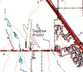
Saginaw Airport (FAA LID: F04) was a public use airport located eight nautical miles (15 km) north of the central business district of Fort Worth, in Tarrant County, Texas, United States.[1] The airport was named for the nearby city of Saginaw, Texas.
Saginaw Airport | |||||||||||
|---|---|---|---|---|---|---|---|---|---|---|---|
 | |||||||||||
| Summary | |||||||||||
| Airport type | Public | ||||||||||
| Owner | J.D. McNeill | ||||||||||
| Serves | Fort Worth, Texas | ||||||||||
| Elevation AMSL | 770 ft / 235 m | ||||||||||
| Coordinates | 32°51′45″N 097°22′41″W | ||||||||||
| Map | |||||||||||
 | |||||||||||
| Runways | |||||||||||
| |||||||||||
| Statistics (1998) | |||||||||||
| |||||||||||
Source: Federal Aviation Administration[1] | |||||||||||
The airport is closed and was removed from FAA records between May and July 2009.
Facilities and aircraft
Saginaw Airport covered an area of 40 acres (16 ha) at an elevation of 770 feet (235 m) above mean sea level. It had one asphalt paved runway designated 18/36 which measured 2,600 by 30 feet (792 x 9 m).[1]
For the 12-month period ending February 24, 1998, the airport had 2,050 general aviation aircraft operations, an average of 170 per month. At that time there were 40 aircraft based at this airport, all single-engine.[1]
References
- "F04: Saginaw Airport". FAA (republished by AirNav). 30 October 2003. Archived from the original on 5 December 2003.
External links
- Saginaw Airport (F04), Saginaw, TX at Abandoned & Little-Known Airfields
- Aerial image as of 1 February 2001 from USGS The National Map
Другой контент может иметь иную лицензию. Перед использованием материалов сайта WikiSort.org внимательно изучите правила лицензирования конкретных элементов наполнения сайта.
WikiSort.org - проект по пересортировке и дополнению контента Википедии