avia.wikisort.org - Aerodrome
St Helens Airport (IATA: HLS, ICAO: YSTH) is a small Australian regional airport located 2 nautical miles (3.7 km; 2.3 mi) east[1] of St Helens on the north-east coast of Tasmania.
St Helens Airport | |||||||||||
|---|---|---|---|---|---|---|---|---|---|---|---|
| |||||||||||
| Summary | |||||||||||
| Airport type | Public | ||||||||||
| Operator | Break O'Day Council | ||||||||||
| Location | St Helens, Tasmania | ||||||||||
| Elevation AMSL | 158 ft / 48 m | ||||||||||
| Coordinates | 41°20′12″S 148°16′54″E | ||||||||||
| Map | |||||||||||
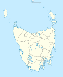 YSTH Location in Tasmania | |||||||||||
| Runways | |||||||||||
| |||||||||||
Sources: Australian AIP and aerodrome chart[1] | |||||||||||
The airport is commonly used to transport fresh seafood from the east coast to the Australian mainland. The airport also has a small flying school and scenic flights also operate out of the airport. The airport has one unsealed runway and a NDB beacon on 392 kHz.
See also
References
- YSTH – St Helens (PDF). AIP En Route Supplement from Airservices Australia, effective 2022-03-24, Aeronautical Chart
East Coast region of Tasmania, Australia | |||||
|---|---|---|---|---|---|
| Settlements | |||||
| Governance former |
| ||||
| Mountains | |||||
| Protected areas, parks and reserves |
| ||||
| Harbours, bays, inlets and estuaries | |||||
| Landmarks |
| ||||
| People of note |
| ||||
| Islands |
| ||||
| Books and newspapers |
| ||||
| Flora, fauna, and fishlife |
| ||||
| Bioregions |
| ||||
| |||||
This article about an Australian airport is a stub. You can help Wikipedia by expanding it. |
На других языках
- [en] St Helens Airport
[ru] Сент-Хеленс (аэропорт)
Аэропорт Сент-Хеленс (англ. St Helens Airport) — малый региональный аэропорт Австралии. Расположен в 3,7 км. к северо-востоку от города Сент-Хеленс, штат Тасмания.Текст в блоке "Читать" взят с сайта "Википедия" и доступен по лицензии Creative Commons Attribution-ShareAlike; в отдельных случаях могут действовать дополнительные условия.
Другой контент может иметь иную лицензию. Перед использованием материалов сайта WikiSort.org внимательно изучите правила лицензирования конкретных элементов наполнения сайта.
Другой контент может иметь иную лицензию. Перед использованием материалов сайта WikiSort.org внимательно изучите правила лицензирования конкретных элементов наполнения сайта.
2019-2025
WikiSort.org - проект по пересортировке и дополнению контента Википедии
WikiSort.org - проект по пересортировке и дополнению контента Википедии