avia.wikisort.org - Aerodrome
Tuy Hoa Airport (IATA: TBB, ICAO: VVTH) (Vietnamese: Sân bay Tuy Hòa) is located just south of Tuy Hòa within the Phú Yên Province, along the central coast of southern Vietnam.
Tuy Hoa Airport Sân bay Tuy Hòa | |||||||||||||||||||
|---|---|---|---|---|---|---|---|---|---|---|---|---|---|---|---|---|---|---|---|
| |||||||||||||||||||
| Summary | |||||||||||||||||||
| Airport type | Public | ||||||||||||||||||
| Operator | Middle Airport Authority | ||||||||||||||||||
| Location | Tuy Hòa, Vietnam | ||||||||||||||||||
| Elevation AMSL | 6 m / 20 ft | ||||||||||||||||||
| Coordinates | 13°02′58″N 109°20′01″E | ||||||||||||||||||
| Website | tuyhoaairport | ||||||||||||||||||
| Map | |||||||||||||||||||
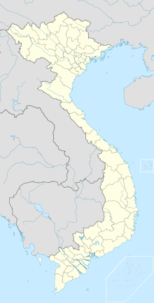 TBB Location of the airport in Vietnam | |||||||||||||||||||
| Runways | |||||||||||||||||||
| |||||||||||||||||||
It was built in 1966 for the United States Air Force as Tuy Hoa Air Base. It was used by the U.S. Air Force (1966–70) and U.S. Army (1970-71), during the Vietnam War. It was transferred to the Republic of Vietnam in 1971, and came under Communist control after the South Vietnamese collapse of 1975.
Airlines and destinations
| Airlines | Destinations |
|---|---|
| Bamboo Airways | Hanoi, Ho Chi Minh City[3] |
| Pacific Airlines | Ho Chi Minh City |
| VietJet Air | Hanoi,[4] Ho Chi Minh City |
| Vietnam Airlines | Hanoi, Ho Chi Minh City[5] |
References
- Airport information for VVTH at Great Circle Mapper.
- Airport information for Tuy Hoa Airport at Transport Search website.
- "Bamboo Airways khai trương đường bay Tuy Hoà - Hà Nội, TP HCM" (in Vietnamese). VnExpress. 22 January 2021. Retrieved 22 January 2021.
- "Vietjet Air Adds New Domestic Routes from May 2016". airlineroute. Retrieved 28 April 2016.
- "Vietnam Airlines đồng loạt mở thêm nhiều đường bay nội địa mới". Vietnam Airlines (in Vietnamese). Retrieved 1 June 2020.
External links
This article about a Vietnamese building or structure is a stub. You can help Wikipedia by expanding it. |
This article about transport in Vietnam is a stub. You can help Wikipedia by expanding it. |
На других языках
[de] Flughafen Dong Tac
Der Flughafen Dong Tac (vietnamesisch: Sân bay Đông Tác), früher englisch Tuy Hoa Air Base, ist ein Flughafen von Đông Tác in der Provinz Phú Yên in Vietnam.- [en] Tuy Hoa Airport
[fr] Aérodrome de Đông Tác
L'aéroport de Đông Tác (code IATA : TBB • code OACI : VVTH) est un petit aéroport qui dessert le district de Tuy Hoa, Viêt Nam. Elle fut utilisée par l'US Air Force et la Force aérienne vietnamienne pendant la guerre du Viêt Nam.[ru] Туихоа (аэропорт)
Аэропорт Донгта́к (вьетн. Sân bay Đông Tác, ИАТА: TBB, ИКАО: VVTH) — вьетнамский коммерческий аэропорт, расположенный к югу от города Туихоа (провинция Фуйен). Административно аэропорт находится в уезде Туихуа, в 6 км от города Туихоа.Текст в блоке "Читать" взят с сайта "Википедия" и доступен по лицензии Creative Commons Attribution-ShareAlike; в отдельных случаях могут действовать дополнительные условия.
Другой контент может иметь иную лицензию. Перед использованием материалов сайта WikiSort.org внимательно изучите правила лицензирования конкретных элементов наполнения сайта.
Другой контент может иметь иную лицензию. Перед использованием материалов сайта WikiSort.org внимательно изучите правила лицензирования конкретных элементов наполнения сайта.
2019-2025
WikiSort.org - проект по пересортировке и дополнению контента Википедии
WikiSort.org - проект по пересортировке и дополнению контента Википедии