avia.wikisort.org - Aerodrome
Chhatrapati Sambhaji Raje International Airport is a proposed greenfield airport project to serve the city of Pune, India. It will be built near Saswad and Jejuri in Purandar Talukas of Pune District in the Indian state of Maharashtra. The proposed airport will be spread over 2,400 hectares.[2][3] The Government of Maharashtra has declared that the first flight from this airport is expected to take off by 2019 and the airport will be named after the King of Maratha Empire, Sambhaji Maharaj who was born at Purandar fort.[4] The CIDCO will hold a 51 percent stake in the SPV, while MADC's stake will be around 19 percent. The remaining 30 percent will be divided between the Maharashtra Industrial Development Corporation (MIDC) and Pune Metropolitan Region Development Authority (PMRDA).[5] The Airports Authority of India conducted surveys on various areas near Pune for a new airport for the city. Initially, a site near Chakan was fixed for the airport. But due to opposition from local farmers and the mountainous terrain, the government decided to build the new airport in Purandar Taluka as it was a flatter region compared to Chakan. This airport will also boost trade from Pune and neighboring districts as it will have its own dedicated cargo terminal.[6]
This article has multiple issues. Please help improve it or discuss these issues on the talk page. (Learn how and when to remove these template messages)
|
Chhatrapati Sambhaji Raje International Airport[1] | |||||||||||||||
|---|---|---|---|---|---|---|---|---|---|---|---|---|---|---|---|
| |||||||||||||||
| Summary | |||||||||||||||
| Airport type | Public | ||||||||||||||
| Owner | City and Industrial Development Corporation | ||||||||||||||
| Operator | Maharashtra Airport Development Company | ||||||||||||||
| Serves | Pune Metropolitan Area | ||||||||||||||
| Location | Purandar, Pune district, Maharashtra | ||||||||||||||
| Elevation AMSL | 2,277 ft / 694 m | ||||||||||||||
| Coordinates | 18°20′56″N 074°08′02″E | ||||||||||||||
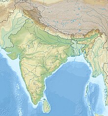
| Map | |||||||||||||||
| Runways | |||||||||||||||
| |||||||||||||||
Background
Lohagaon Air Force Station serves as the main passenger airport for the city. Due to its status as a "restricted international airport", only two to four international flights can operate from there. Moreover, it is an Air Force base and has a single civil terminal which operates both international as well as domestic traffic.[7]
Almost 65 to 70 flights operate connecting major domestic destinations. This is crowding the existing airport and leading to delay of flights as the airport has only eight parking bays. Out of which, one is used for VIP's and other is used for charter operations and the remaining carry the load of international as well as domestic flights. Hence, this led to the need for a dedicated international airport for the city as the city is one of the fastest-growing cities in India and is included in the Smart City program of the Indian government. However, until completion of the new international airport, the existing airport will be expanded with a second terminal.[8]
Connection
The project site is located near the villages of Ambodi, Sonori, Kumbharvalan, Ekhatpur-Munjawadi, Khanwadi, Pargaon Memane, Rajewadi, Aamble, Tekwadi, Vanpuri, Udachiwadi, and Singapur. Rajewadi railway station on the Pune–Miraj–Lonand line is nearest to the site. The proposed airport will be connected with six different routes including national highways 48 and 65. There will also be a special ring-road connecting major industrial establishments with the proposed airport from Hadapsar.[9]
Proposed Airport Structure
The new Pune International Airport, which is set to come up at Purandar, will serve as a cargo hub for the state. There are many farmers in nearby areas like Satara who, apart from other crops, cultivate fruits like grapes and pomegranates. With the new airport and the state-of-the-art cargo, their crops can be easily transported to other states and countries globally. Maharashtra at present does not have a good cargo network. A proper cargo hub will do wonders for the state in terms of revenue as exports can be smoothly processed. Moreover, it will create a lot of job opportunities.
The new airport will be connected by six different routes including national highways 4 and 17. There will be a special ring road connecting major industrial estates with the proposed airport from Hadapsar.[10]
References
- "Chhatrapati Sambhaji Raje Airport". Indian Express. 7 October 2016. Retrieved 8 October 2016.
- "It's official: Pune to get new international airport at Purandar". Times of India. 7 October 2016. Retrieved 8 October 2016.
- "Airports Authority Selects Purandar For International Airport Near Pune: Devendra Fadnavis". NDTV. 7 October 2016. Retrieved 8 October 2016.
- Gordon, Stewart (1993). The Marathas 1600-1818 (1. publ. ed.). New York: Cambridge University. pp. 74–78. ISBN 978-0-521-26883-7.
- "Cabinet nod to form SPV for Purandar intl airport in Pune". 5 March 2019. Retrieved 5 March 2017.
- "Proposed airport to be cargo hub, says MADC". 17 December 2016. Retrieved 27 March 2017.
- "It's official: Pune to get new international airport at Purandar". Times of India. 7 October 2016. Retrieved 8 October 2016.
- "New airport will take 5 years to start operational". 16 February 2017. Retrieved 27 March 2017.
- "Pune to get new greenfield international airport at Purandar". The Times of India. 7 October 2016. Retrieved 3 June 2018.
- "Proposed airport to be cargo hub, says MADC | Pune News - Times of India". The Times of India.
External links
Другой контент может иметь иную лицензию. Перед использованием материалов сайта WikiSort.org внимательно изучите правила лицензирования конкретных элементов наполнения сайта.
WikiSort.org - проект по пересортировке и дополнению контента Википедии


