avia.wikisort.org - Aerodrome
Hay River/Merlyn Carter Airport (IATA: YHY, ICAO: CYHY) is located 1.5 nautical miles (2.8 km; 1.7 mi) north of Hay River, Northwest Territories, Canada.
This article uses bare URLs, which are uninformative and vulnerable to link rot. (August 2022) |
Hay River/Merlyn Carter Airport | |||||||||||||||
|---|---|---|---|---|---|---|---|---|---|---|---|---|---|---|---|
 Hay River Airport sign | |||||||||||||||
 Airport terminal | |||||||||||||||
| |||||||||||||||
| Summary | |||||||||||||||
| Airport type | Public | ||||||||||||||
| Operator | Government of the Northwest Territories | ||||||||||||||
| Location | Hay River, Northwest Territories | ||||||||||||||
| Time zone | MST (UTC−07:00) | ||||||||||||||
| • Summer (DST) | MDT (UTC−06:00) | ||||||||||||||
| Elevation AMSL | 541 ft / 165 m | ||||||||||||||
| Coordinates | 60°50′23″N 115°46′58″W | ||||||||||||||
| Map | |||||||||||||||
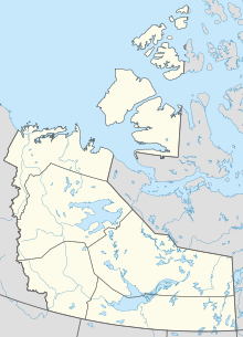 CYHY Location in the Northwest Territories  CYHY CYHY (Canada) | |||||||||||||||
| Runways | |||||||||||||||
| |||||||||||||||
| Statistics (2010) | |||||||||||||||
| |||||||||||||||
The airport is named for former bush pilot Merlyn Carter, who was killed by a black bear in 2005.[4]
Sandhill cranes may be found nesting on the airport from May until September.
Airlines and destinations
| Airlines | Destinations |
|---|---|
| Air Tindi | Yellowknife[5] |
| Canadian North | Yellowknife[6] |
| Northwestern Air | Edmonton, Fort Smith, High Level |
Cargo
| Airlines | Destinations |
|---|---|
| Buffalo Airways | Yellowknife |
See also
References
- Canada Flight Supplement. Effective 0901Z 16 July 2020 to 0901Z 10 September 2020.
- Synoptic/Metstat Station Information Archived June 28, 2013, at the Wayback Machine
- Total aircraft movements by class of operation
- Bear mauls N.W.T. pilot to death
- https://airtindi.com
- Full network schedule
External links
Wikimedia Commons has media related to Hay River Airport.
- Past three hours METARs, SPECI and current TAFs for Hay River Airport from Nav Canada as available.
Airports in Canada | |
|---|---|
| By name | |
| By location indicator | |
| By province/territory | |
| By area | |
| National Airports System | |
| Related | |
| |
This article about an airport in the Northwest Territories is a stub. You can help Wikipedia by expanding it. |
На других языках
- [en] Hay River/Merlyn Carter Airport
[es] Aeropuerto de Hay River
El Aeropuerto de Hay River (en inglés: Hay River Airport) (IATA: YHY, OACI: CYHY) está ubicado a 1.5 MN al norte de Hay River, Territorios del Noroeste, Canadá. De mayo a septiembre se pueden observar grullas canadienses haciendo nido cerca a este aeropuerto.[fr] Aéroport de Hay River-Merlyn Carter
L'aéroport Hay River-Merlyn Carter est un aéroport situé dans les Territoires du Nord-Ouest, au Canada.Текст в блоке "Читать" взят с сайта "Википедия" и доступен по лицензии Creative Commons Attribution-ShareAlike; в отдельных случаях могут действовать дополнительные условия.
Другой контент может иметь иную лицензию. Перед использованием материалов сайта WikiSort.org внимательно изучите правила лицензирования конкретных элементов наполнения сайта.
Другой контент может иметь иную лицензию. Перед использованием материалов сайта WikiSort.org внимательно изучите правила лицензирования конкретных элементов наполнения сайта.
2019-2026
WikiSort.org - проект по пересортировке и дополнению контента Википедии
WikiSort.org - проект по пересортировке и дополнению контента Википедии