avia.wikisort.org - Aerodrome

Search / Calendar

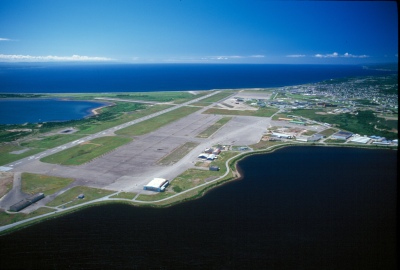
This is a list of airports in Newfoundland and Labrador. It includes all Nav Canada certified and registered water and land airports, aerodromes and heliports in the Canadian province of Newfoundland and Labrador.[1][2] Airport names in italics are part of the National Airports System.[3]

Newfoundland and Labrador

List of airports and heliports


Wabush Airport
Wabush Airport
Stephenville International Airport
St. John's International Airport
CFB Goose Bay
CFB Goose Bay
Gander International Airport
Natuashish Airport
Natuashish Airport
Goose (Otter Creek) Water Aerodrome

The list is sorted by the name of the community served; click the sort buttons in the table header to switch listing order.

Community   Airport name   ICAO   TC LID   IATA   Coordinates  
Bell IslandBell Island AirportCCV447°38′06″N 052°59′49″W
Black TickleBlack Tickle AirportCCE4YBI53°28′12″N 055°47′15″W
BotwoodExploits Valley (Botwood) AirportCCP249°03′22″N 055°26′52″W
CartwrightCartwright AirportCYCAYRF53°40′58″N 057°02′31″W
CharlottetownCharlottetown AirportCCH4YHG52°45′54″N 056°06′56″W
Churchill FallsChurchill Falls AirportCZUMZUM53°33′43″N 064°06′23″W
ClarenvilleClarenville AirportCCZ348°16′29″N 053°55′26″W
Conne RiverConne River Water AerodromeCCR847°55′30″N 055°34′40″W
Deer LakeDeer Lake Regional AirportCYDFYDF49°12′40″N 057°23′29″W
FogoFogo AerodromeCDY349°39′27″N 054°14′15″W
FoxtrapLong Pond HeliportCCX247°30′58″N 052°58′51″W
GanderGander International AirportCYQXYQX48°56′13″N 054°34′05″W
GanderGander (James Paton Memorial Regional Health Centre) HeliportCGH248°57′19″N 054°37′38″W
Goose Air Weapons RangeGoose Air Weapons Range Aerodrome[4]52°17′20.5″N 060°57′13.1″W
Grand Falls-WindsorGrand Falls-Windsor HeliportCFW848°55′29″N 055°38′50″W
Happy Valley-Goose BayCFB Goose Bay (Goose Bay Airport)CYYRYYR53°19′09″N 060°25′33″W
Happy Valley-Goose BayGoose (Otter Creek) Water AerodromeCCB553°21′00″N 060°25′00″W
Harbour GraceHarbour Grace AirportCHG247°41′08″N 053°15′14″W
HopedaleHopedale AirportCYHOYHO55°26′54″N 060°13′43″W
Long Harbour RiverLong Harbour River HeliportCLH747°54′16″N 054°55′13″W
MakkovikMakkovik AirportCYFTYMN55°04′38″N 059°11′15″W
Mary's HarbourMary's Harbour AirportCYMHYMH52°18′10″N 055°50′52″W
NainNain AirportCYDPYDP56°33′02″N 061°40′56″W
NatuashishNatuashish AirportCNH255°54′50″N 061°11′04″W
Port au ChoixPort au Choix AirportCCM450°41′20″N 057°19′53″W
Port Hope SimpsonPort Hope Simpson AirportCCP4YHA52°31′41″N 056°17′10″W
PostvillePostville AirportCCD4YSO54°54′37″N 059°47′07″W
RigoletRigolet AirportCCZ2YRG54°10′47″N 058°27′27″W
St. Andrew'sSt. Andrews (Codroy Valley) AirportCDA547°46′33″N 059°18′45″W
St. AnthonySt. Anthony AirportCYAYYAY51°23′31″N 056°04′59″W
St. John'sSt. John's International AirportCYYTYYT47°37′07″N 052°45′09″W
St. John'sSt. John's (Health Sciences Centre) HeliportCCK247°34′21″N 052°44′44″W
St. John'sSt. John's (Paddys Pond) Water AerodromeCCQ547°28′00″N 052°54′00″W
St. John'sSt. John's (Universal) HeliportCDC247°36′30″N 052°43′37″W
St. LewisSt. Lewis (Fox Harbour) AirportCCK452°22′22″N 055°40′26″W
South BrookSouth Brook Water AerodromeCCT549°01′00″N 057°38′00″W
SpringdaleSpringdale AirportCCD249°28′44″N 056°10′41″W
SpringdaleSpringdale/Davis Pond Water AerodromeCDU449°33′00″N 056°03′00″W
StephenvilleStephenville International AirportCYJTYJT48°32′29″N 058°33′00″W
Thorburn LakeThorburn Lake Water AerodromeCCW548°16′00″N 054°09′00″W
Voisey's Bay MineVoisey's Bay AerodromeCVB256°20′41″N 062°05′17″W
WabushWabush AirportCYWKYWK52°55′22″N 066°51′53″W
WabushWabush Water AerodromeCCX552°56′00″N 066°54′00″W
WinterlandWinterland AirportCCC247°08′13″N 055°19′45″W

Defunct airports


Community   Airport name   ICAO   TC LID   IATA   Coordinates  
ArgentiaNaval Station ArgentiaCWARNWP47°18′22″N 053°59′24″W
Bay d'EspoirBay d'Espoir AerodromeCCX447°57′30″N 055°51′14″W
BonavistaBonavista AerodromeCWVA48°34′00″N 053°03′27″W
BuchansBuchans AirportCYZM48°50′50″N 056°50′20″W
Davis InletDavis Inlet Aerodrome[5]CCB4YDI55°53′51″N 060°54′28″W
Hope Brook Gold MineHope Brook Aerodrome47°43′21″N 058°03′33″W
LivingstonLivingston Aerodrome53°55′41″N 066°27′39″W
Churchill Falls Generating StationMichelin Falls Aerodrome[6]53°37′39″N 064°29′17″W
Menihek Generating StationMenihek Aerodrome54°27′15″N 066°35′35″W
Mid-Canada Line Site 212Border Beacon[7]55°19′59.2″N 063°12′16.7″W
Paradise RiverParadise River AirportCDF4YDE53°25′38″N 057°13′51″W
EmerilRoss Bay Junction Airport[8]53°01′43″N 066°14′40″W
StephenvilleErnest Harmon Air Force Base48°32′29″N 058°33′00″W
Saglek BaySaglek Airport (RCAF Station Saglek)CYSVYSV58°28′28″N 062°39′15″W
Twin FallsTwin Falls Aerodrome53°29′19″N 064°30′45″W
William's HarbourWilliams Harbour AirportCCA652°34′03″N 055°47′06″W

References


Map all coordinates using: OpenStreetMap 
Download coordinates as: KML

На других языках


- [en] List of airports in Newfoundland and Labrador

[fr] Liste des aéroports à Terre-Neuve-et-Labrador

Il s'agit d'une liste alphabétique des aéroports, des aérodromes et des héliports d'une province ou d'un territoire du Canada. Ils sont énumérés dans le format :

[ru] Список аэропортов Ньюфаундленда и Лабрадора

Список аэропортов канадской провинции Ньюфаундленд и Лабрадор.


Текст в блоке "Читать" взят с сайта "Википедия" и доступен по лицензии Creative Commons Attribution-ShareAlike; в отдельных случаях могут действовать дополнительные условия.

Другой контент может иметь иную лицензию. Перед использованием материалов сайта WikiSort.org внимательно изучите правила лицензирования конкретных элементов наполнения сайта.

2019-2025
WikiSort.org - проект по пересортировке и дополнению контента Википедии