| Community |
Airport name |
ICAO |
TC LID |
IATA |
Coordinates |
|---|
| Alida | Alida/Cowan Farm Private Aerodrome | | CCF7 | | 49°23′47″N 101°49′30″W |
| Allan | Allan Aerodrome | | CAN5 | | 51°45′55″N 106°04′05″W |
| Arborfield | Arborfield Airport | | CJM6 | | 53°06′28″N 103°39′02″W |
| Arcola | Arcola Airport | | CJA7 | | 49°38′00″N 102°29′00″W |
| Assiniboia | Assiniboia Airport | | CJN4 | | 49°44′05″N 105°56′49″W |
| Axe Lake oil sands | Axe Lake Aerodrome | | CAX2 | | 57°16′09″N 109°50′51″W |
| Beauval | Beauval Airport | | CJK3 | | 55°06′37″N 107°42′59″W |
| Biggar | Biggar Airport | | CJF8 | | 52°03′04″N 107°59′18″W |
| Big River | Big River Airport | | CKX8 | | 53°50′10″N 107°00′34″W |
| Birch Hills | Birch Hills Airport | | CJD3 | | 52°59′27″N 105°26′41″W |
| Briercrest | Briercrest South Airport | | CBS7 | | 50°03′59″N 105°18′02″W |
| Buffalo Narrows | Buffalo Narrows Airport | CYVT | | YVT | 55°50′31″N 108°25′03″W |
| Buffalo Narrows | Buffalo Narrows (Fire Centre) Heliport | | CBN3 | | 55°50′03″N 108°24′15″W |
| Buffalo Narrows | Buffalo Narrows Water Aerodrome | | CJB7 | | 55°51′00″N 108°29′00″W |
| Cabri | Cabri Airport | | CJJ5 | | 50°37′10″N 108°27′58″W |
| Camp Grayling | Black Lake Water Aerodrome | | CJZ6 | | 59°09′00″N 105°33′00″W |
| Camsell Portage | Camsell Portage Airport | | CJP6 | | 59°36′36″N 109°16′01″W |
| Candle Lake | Candle Lake Airpark | | CCL2 | | 53°46′06″N 105°18′28″W |
| Canora | Canora Airport | | CJR7 | | 51°37′44″N 102°27′00″W |
| Carlyle | Carlyle Airport | | CJQ3 | | 49°38′39″N 102°17′10″W |
| Central Butte | Central Butte Airport | | CJC4 | | 50°48′05″N 106°29′18″W |
| Charlot River Power Station | Charlot River Airport | | CJP9 | | 59°36′05″N 109°08′18″W |
| Churchbridge | Churchbridge Airport | | CKV6 | | 51°01′00″N 101°49′00″W |
| Cigar Lake Mine | Cigar Lake Airport | | CJW7 | | 58°03′11″N 104°29′04″W |
| Collins Bay | Collins Bay Airport | CYKC | | | 58°14′10″N 103°40′40″W |
| Coronach/Scobey, Montana | Coronach/Scobey Border Station Airport | | CKK3 | | 49°00′00″N 105°23′56″W |
| Craik | Craik Airport | | CJC2 | | 51°03′22″N 105°50′18″W |
| Cree Lake | Cree Lake/Crystal Lodge (Midgett Field) Aerodrome | | CKS8 | | 57°27′51″N 106°44′54″W |
| Cree Lake | Cree Lake (Crystal Lodge) Water Aerodrome | | CRE4 | | 57°27′43″N 106°44′46″W |
| Cudworth | Cudworth Municipal Airport | | CJD2 | | 52°29′00″N 105°43′02″W |
| Cumberland House | Cumberland House Airport | | CJT4 | | 53°57′22″N 102°17′54″W |
| Cupar | Loon Creek Airfield | | CLC4 | | 50°50′44″N 104°19′25″W |
| Davidson | Davidson Municipal Airport | | CJC3 | | 51°14′52″N 105°58′35″W |
| Debden | Debden Airport | | CKH3 | | 53°31′55″N 106°53′02″W |
| Dinsmore | Dinsmore Aerodrome | | CKX5 | | 51°19′50″N 107°26′15″W |
| Dore Lake | Dore Lake Airport | | CJE2 | | 54°37′00″N 107°23′00″W |
| Eatonia | Eatonia (Elvie Smith) Municipal Airport | | CJG2 | | 51°13′08″N 109°23′33″W |
| Edam | Edam Airport | | CJU7 | | 53°11′06″N 108°47′21″W |
| Elstow | Elstow/Combine World Field Aerodrome | | CEW2 | | 52°00′01″N 106°06′58″W |
| Esterhazy | Esterhazy Airport | | CJK4 | | 50°38′34″N 102°06′01″W |
| Estevan | Estevan Regional Aerodrome | CYEN | | YEN | 49°12′37″N 102°57′57″W |
| Estevan | Estevan (Blue Sky) Aerodrome | | CBS2 | | 49°17′38″N 103°01′11″W |
| Estevan | Estevan (St. Josephs's Hospital) Heliport | | CSJ3 | | 49°09′11″N 103°00′47″W |
| Eston | Eston Airport | | CJR4 | | 51°08′39″N 108°45′46″W |
| Fillmore | Fillmore Airport | | CKN5 | | 49°52′08″N 103°26′43″W |
| Fond-du-Lac | Fond-du-Lac Airport | CZFD | | ZFD | 59°20′04″N 107°10′55″W |
| Frontier | Frontier Airport | | CJM5 | | 49°10′00″N 108°34′00″W |
| Glaslyn | Glaslyn Airport | | CJE5 | | 53°22′38″N 108°20′32″W |
| Goodsoil | Goodsoil Airport | | CKF4 | | 54°25′00″N 109°14′00″W |
| Gravelbourg | Gravelbourg Airport | | CJM4 | | 49°52′00″N 106°34′00″W |
| Grenfell | Grenfell Airport | | CKU6 | | 50°25′09″N 102°56′07″W |
| Gull Lake | Gull Lake Airport | | CJK5 | | 50°03′28″N 108°29′24″W |
| Hafford | Hafford Airport | | CJC6 | | 52°43′56″N 107°22′27″W |
| Hatchet Lake | Hatchet Lake Airport | | CJL2 | | 58°39′45″N 103°32′18″W |
| Hatchet Lake | Hatchet Lake Water Aerodrome | | CJX8 | | 58°38′00″N 103°35′00″W |
| Hudson Bay | Hudson Bay Airport | CYHB | | YHB | 52°49′00″N 102°18′41″W |
| Humboldt | Humboldt Airport | | CJU4 | | 52°10′34″N 105°07′36″W |
| Île-à-la-Crosse | Île-à-la-Crosse Airport | | CJF3 | | 55°29′23″N 107°55′48″W |
| Ituna | Ituna Airport | | CJM2 | | 51°08′46″N 103°25′34″W |
| Jan Lake | Jan Lake Airport | | CKM4 | | 54°49′51″N 102°47′19″W |
| Kamsack | Kamsack Airport | | CJN2 | | 51°33′35″N 101°52′44″W |
| Kelvington | Kelvington Airport | | CKV2 | | 52°08′00″N 103°32′05″W |
| Kerrobert | Kerrobert Airport | | CJP2 | | 51°55′37″N 109°07′46″W |
| Key Lake | Key Lake Airport | CYKJ | | YKJ | 57°15′23″N 105°37′03″W |
| Kindersley | Kindersley Regional Airport | CYKY | | YKY | 51°30′55″N 109°10′50″W |
| Kipling | Kipling Airport | | CKD5 | | 50°05′57″N 102°36′25″W |
| Kyle | Kyle Airport | | CJB8 | | 50°50′00″N 108°04′12″W |
| La Loche | La Loche Airport | | CJL4 | | 56°28′24″N 109°24′13″W |
| Lampman | Lampman Airport | | CJQ2 | | 49°22′19″N 102°45′48″W |
| Lampman | Lampman/Spitfire Air Aerodrome | | CSF8 | | 49°29′24″N 102°52′58″W |
| Lanigan | Lanigan Airport | | CKC6 | | 51°50′43″N 104°59′32″W |
| La Ronge | La Ronge (Barber Field) Airport | CYVC | | YVC | 55°09′05″N 105°15′43″W |
| La Ronge | La Ronge Heliport | | CJX3 | | 55°06′53″N 105°17′43″W |
| La Ronge | La Ronge Water Aerodrome | | CJZ9 | | 55°06′00″N 105°17′00″W |
| Leader | Leader Airport | | CJD5 | | 50°52′38″N 109°30′02″W |
| Leask | Leask Airport | | CJH8 | | 53°01′00″N 106°45′00″W |
| Lemberg | Lemberg Airport | | CKJ9 | | 50°42′32″N 103°11′48″W |
| Leoville | Leoville Airport | | CJT9 | | 53°37′14″N 107°36′34″W |
| Little Bear Lake | Little Bear Lake Airport | | CKL6 | | 54°17′31″N 104°40′17″W |
| Lloydminster | Lloydminster (Hospital) Heliport | | CLH6 | | 53°16′26″N 109°59′21″W |
| Loon Lake | Loon Lake Airport | | CJW3 | | 54°01′06″N 109°08′07″W |
| Lucky Lake | Lucky Lake Airport | | CKQ5 | | 50°59′39″N 107°07′53″W |
| Lumsden | Disley Aerodrome | | CDS2 | | 50°38′09″N 105°02′09″W |
| Lumsden | Lumsden (Colhoun) Airport | | CKH8 | | 50°40′03″N 104°47′22″W |
| Luseland | Luseland Airport | | CJR2 | | 52°04′10″N 109°22′30″W |
| Macklin | Macklin Airport | | CJJ8 | | 52°20′34″N 109°55′08″W |
| Maidstone | Maidstone Aerodrome | | CJH3 | | 53°05′52″N 109°19′44″W |
| Reindeer Lake | Malcolm Island Airport | | CJS2 | | 56°56′58″N 102°14′21″W |
| Maple Creek | Maple Creek Airport | | CJQ4 | | 49°53′45″N 109°28′30″W |
| Martensville | Saskatoon/Richter Field Aerodrome | | CRF5 | | 52°16′49″N 106°41′02″W |
| McArthur River uranium mine | McArthur River Airport | | CKQ8 | | 57°46′03″N 105°01′27″W |
| Maryfield | Maryfield Aerodrome | | CJQ8 | | 49°50′47″N 101°30′51″W |
| Meadow Lake | Meadow Lake Airport | CYLJ | | YLJ | 54°07′31″N 108°31′22″W |
| Melfort | Melfort (Miller Field) Aerodrome | | CJZ3 | | 52°51′52″N 104°42′03″W |
| Melville | Melville Municipal Airport | | CJV9 | | 50°56′29″N 102°44′16″W |
| Moose Jaw | CFB Moose Jaw (Moose Jaw/Air Vice Marshal C.M. McEwen Airport) | CYMJ | | YMJ | 50°19′49″N 105°33′33″W |
| Moose Jaw | Moose Jaw (Dr. F. H. Wigmore Regional Hospital) Heliport | | CWH6 | | 50°25′12″N 105°31′32″W |
| Moose Jaw | Moose Jaw Municipal Airport | | CJS4 | | 50°26′03″N 105°23′12″W |
| Moosomin | Moosomin Airport | | CJB5 | | 50°10′07″N 101°38′39″W |
| Neilburg | Neilburg Airport | | CJV2 | | 52°49′53″N 109°38′25″W |
| Nekweaga Bay | Nekweaga Bay Airport | | CKN8 | | 57°44′33″N 103°56′41″W |
| Nipawin | Nipawin Airport | CYBU | | YBU | 53°19′58″N 104°00′32″W |
| North Battleford | North Battleford Airport | CYQW | | YQW | 52°46′09″N 108°14′37″W |
| Odessa | Odessa/Strawberry Lakes Aerodrome | | CSL7 | | 50°21′49″N 103°44′30″W |
| Otter Lake | Otter Lake Water Aerodrome | | CKB4 | | 55°36′00″N 104°46′00″W |
| Outlook | Outlook Airport | | CKR9 | | 51°28′57″N 107°02′12″W |
| Oxbow | Oxbow Airport | | CJW2 | | 49°13′26″N 102°08′46″W |
| Pangman | Pangman Airport | | CKC9 | | 49°38′49″N 104°39′55″W |
| Patuanak | Patuanak Airport | | CKB2 | | 55°54′00″N 107°43′14″W |
| Pelican Narrows | Pelican Narrows Airport | | CJW4 | | 55°17′13″N 102°44′59″W |
| Pelican Narrows | Pelican Narrows Water Aerodrome | | CKE4 | | 55°10′00″N 102°56′00″W |
| Pierceland | Pierceland (Turchyn Field) Aerodrome | | CTF5 | | 54°18′01″N 109°55′38″W |
| Pilot Butte | Pilot Butte Airport | | CPB5 | | 50°27′40″N 104°25′50″W |
| Pinehouse | Pinehouse Lake Airport | CZPO | | | 55°31′41″N 106°34′56″W |
| Points North Landing | Points North Landing Airport | CYNL | | YNL | 58°16′36″N 104°04′57″W |
| Points North Landing | Points North Landing Water Aerodrome | | CKC2 | | 58°16′00″N 104°05′00″W |
| Porcupine Plain | Porcupine Plain Airport | | CKD2 | | 52°37′11″N 103°14′52″W |
| Poverty Valley | Poverty Valley Aerodrome | | CPV9 | | 50°02′20″N 107°15′22″W |
| Preeceville | Preeceville Airport | | CJK9 | | 51°57′00″N 102°39′00″W |
| Prince Albert | Prince Albert (Fire Centre) Heliport | | CAL6 | | 53°13′43″N 105°45′21″W |
| Prince Albert | Prince Albert (Glass Field) Airport | CYPA | | YPA | 53°12′51″N 105°40′22″W |
| Quill Lake | Quill Lake Airport | | CKE2 | | 52°04′00″N 104°16′00″W |
| Radisson | Radisson Airport | | CJL9 | | 52°27′47″N 107°22′38″W |
| Radville | Radville Airport | | CKF2 | | 49°27′38″N 104°16′18″W |
| Regina | Regina/Aerogate Aerodrome | | CAG2 | | 50°35′52″N 104°36′04″W |
| Regina | Regina General Hospital Heliport | | CRQ2 | | 50°26′38″N 104°36′05″W |
| Regina | Regina International Airport | CYQR | | YQR | 50°25′55″N 104°39′57″W |
| Regina Beach | Regina Beach Airport | | CKL9 | | 50°45′26″N 104°58′58″W |
| Reindeer Lake | Reindeer Lake Aerodrome | | CRL7 | | 57°17′17″N 102°31′30″W |
| Rockglen | Rockglen Airport | | CKC7 | | 49°10′00″N 105°56′00″W |
| Rosetown | Rosetown Airport | | CJX4 | | 51°33′52″N 107°55′00″W |
| St. Brieux | St. Brieux Airport | | CKK2 | | 52°39′00″N 104°52′00″W |
| Sandy Bay | Sandy Bay Airport | | CJY4 | | 55°32′44″N 102°16′19″W |
| Sandy Bay | Sandy Bay Water Aerodrome | | CKB5 | | 55°31′32″N 102°19′20″W |
| Saskatoon | Saskatoon/Banga International Air Aerodrome | | CJN5 | | 52°00′02″N 106°27′45″W |
| Saskatoon | Saskatoon (Jim Pattison Children's Hospital) Heliport | | CJP4 | | 52°07′55″N 106°38′33″W |
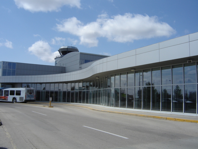
| Saskatoon | Saskatoon John G. Diefenbaker International Airport (Saskatoon International Airport) | CYXE | | YXE | 52°10′15″N 106°41′59″W |
| Seabee Gold Mine | Seabee Mine Aerodrome | | CCB2 | | 55°41′19″N 103°36′039″W |
| Shaunavon | Shaunavon Airport | | CJC5 | | 49°39′32″N 108°24′23″W |
| Shellbrook | Shellbrook Airport | | CJZ4 | | 53°13′42″N 106°21′47″W |
| Southend | Southend/Hans Ulricksen Field Aerodrome | | CKA9 | | 56°20′11″N 103°17′37″W |
| Southend | Southend Water Aerodrome | | CKP5 | | 56°20′00″N 103°17′00″W |
| Spiritwood | Spiritwood/H & M Fast Farms Aerodrome | | CHM2 | | 53°16′30″N 107°34′13″W |
| Spring Valley | Spring Valley (North) Airport | | CKP2 | | 50°03′36″N 105°24′07″W |
| Stony Rapids | Stony Rapids Airport | CYSF | | YSF | 59°15′01″N 105°50′29″W |
| Stony Rapids | Stony Rapids Water Aerodrome | | CKW5 | | 59°15′36″N 105°49′52″W |
| Swift Current | Swift Current Airport | CYYN | | YYN | 50°17′31″N 107°41′26″W |
| Tisdale | Tisdale Airport | | CJY3 | YTT | 52°50′12″N 104°04′00″W |
| Unity | Unity Aerodrome | | CKE8 | | 52°26′45″N 109°11′07″W |
| Uranium City | Uranium City Airport | CYBE | | YBE | 59°33′41″N 108°28′53″W |
| Uranium City | Uranium City Water Aerodrome | | CKG6 | | 59°34′00″N 108°36′00″W |
| Wadena | Wadena Airport | | CKS7 | | 51°56′00″N 103°50′00″W |
| Wakaw | Wakaw Airport | | CKT7 | | 52°39′00″N 105°46′00″W |
| Watrous | Watrous Airport | | CKU7 | | 51°41′07″N 105°22′12″W |
| Weyburn | Weyburn Airport | | CJE3 | | 49°41′51″N 103°48′03″W |
| Whitewood | Whitewood Airport | | CKY2 | | 50°20′00″N 102°16′00″W |
| Wollaston Lake | Wollaston Lake Airport | CZWL | | ZWL | 58°06′25″N 103°10′20″W |
| Wynyard | Wynyard/W. B. Needham Field Aerodrome | CYYO | | | 51°48′33″N 104°10′09″W |
| Yorkton | Yorkton Municipal Airport | CYQV | | YQV | 51°15′53″N 102°27′42″W |