| Community |
Airport name |
ICAO |
TC LID |
IATA |
Coordinates |
|---|
| Altona | Altona Municipal Airport | | CJL6 | | 49°05′40″N 097°32′02″W |
| Arborg | Arborg Airport | | CJU6 | | 50°54′46″N 097°18′16″W |
| Ashern | Ashern Airport | | CJE7 | | 51°09′31″N 098°19′55″W |
| Bakers Narrows | Flin Flon/Bakers Narrows Water Aerodrome | | CFF8 | | 54°40′43″N 101°39′37″W |
| Beausejour | Beausejour/AV-Ranch Airpark | | CAV6 | | 50°02′28″N 096°35′09″W |
| Berens River | Berens River Airport | CYBV | | YBV | 52°21′32″N 097°01′06″W |
| Big Sand Lake | Big Sand Lake Airport | | CJQ9 | | 57°37′10″N 099°52′31″W |
| Bissett | Bissett Water Aerodrome | | CJY6 | | 51°01′00″N 095°41′00″W |
| Bloodvein First Nation | Bloodvein River Airport | CZTA | | YDV | 51°47′04″N 096°41′32″W |
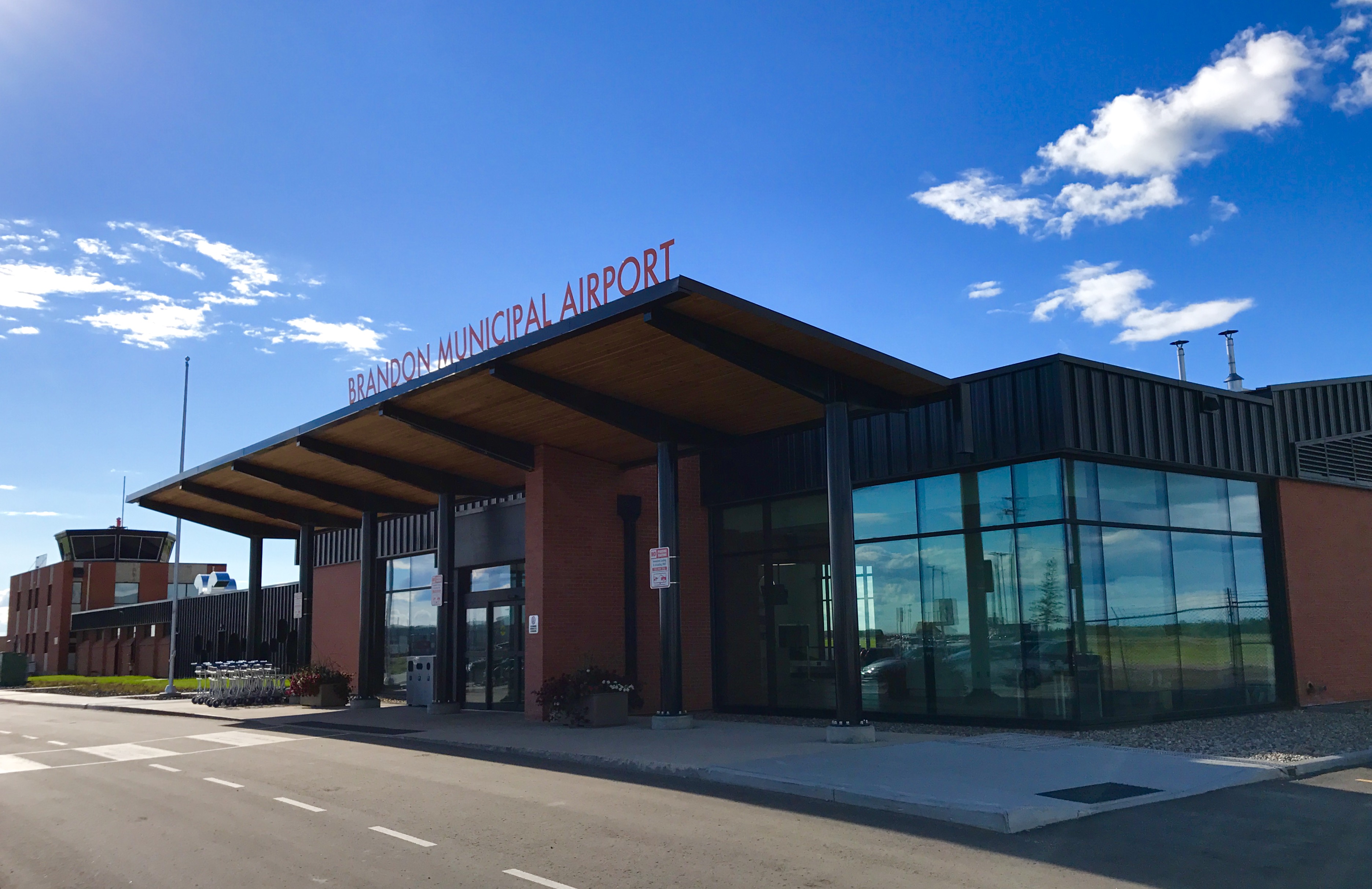
| Brandon | Brandon Municipal Airport (McGill Field) | CYBR | | YBR | 49°54′36″N 099°57′07″W |
| Brochet | Brochet Airport | CYBT | | YBT | 57°53′22″N 101°40′45″W |
| Carman | Carman/Friendship Field Airport | | CJB2 | | 49°29′29″N 098°01′07″W |
| Carman | Carman (South) Airport | | CJS7 | | 49°28′49″N 098°00′54″W |
| Churchill | Churchill Airport | CYYQ | | YYQ | 58°44′21″N 094°03′54″W |
| Churchill | Churchill (Hudson Bay Helicopters) Heliport | | CHB2 | | 58°45′59″N 094°10′04″W |
| Churchill | Churchill Water Aerodrome | | CJJ7 | | 58°42′00″N 094°03′00″W |
| Cooks Creek | Cooks Creek Aerodrome | | CCC3 | | 50°01′55″N 096°43′58″W |
| Cross Lake | Cross Lake (Charlie Sinclair Memorial) Airport | CYCR | | YCR | 54°36′39″N 097°45′37″W |
| Crystal City | Crystal City-Pilot Mound/Louise Municipal Airport | | CKZ6 | | 49°08′50″N 098°52′51″W |
| Dauphin | Lt. Col W.G. (Billy) Barker VC Airport
(Dauphin (Lt. Col W.G. (Billy) Barker VC) Airport) | CYDN | | YDN | 51°06′03″N 100°03′09″W |
| Deloraine | Deloraine Airport | | CJJ4 | | 49°09′02″N 100°30′02″W |
| Easterville | Easterville Airport | | CKM6 | | 53°06′31″N 099°47′52″W |
| Elk Island | Elk Island Airport | | CKZ3 | | 54°40′17″N 094°08′43″W |
| Erickson | Erickson Municipal Airport | | CKQ6 | | 50°29′58″N 099°53′52″W |
| Fisher Branch | Fisher Branch Airport | | CKX4 | | 51°05′00″N 097°29′00″W |
| Flin Flon | Flin Flon Airport | CYFO | | YFO | 54°40′41″N 101°40′54″W |
| Flin Flon | Flin Flon/Channing Water Aerodrome | | CJK8 | | 54°45′00″N 101°50′00″W |
| Fraserwood | Fraserwood/Tribble Ranch Field Aerodrome | | CTR8 | | 50°35′33″N 097°17′59″W |
| Gillam | Gillam Airport | CYGX | | YGX | 56°21′27″N 094°42′38″W |
| Gillam | Gillam Water Aerodrome | | CJP8 | | 56°21′14″N 094°39′26″W |
| Gimli | Gimli Industrial Park Airport | CYGM | | YGM | 50°37′41″N 097°02′36″W |
| Gladstone | Gladstone Aerodrome | | CJR5 | | 50°09′49″N 098°56′33″W |
| Glenboro | Glenboro Airport | | CJJ2 | | 49°33′00″N 099°20′00″W |
| Gods Lake | Gods Lake Airport | | CJB6 | | 54°46′45″N 093°43′01″W |
| Gods Lake Narrows | Gods Lake Narrows Airport | CYGO | | YGO | 54°33′30″N 094°29′27″W |
| Gods River | Gods River Airport | CZGI | | ZGI | 54°50′23″N 094°04′43″W |
| Grand Rapids | Grand Rapids Airport | | CJV8 | | 53°10′21″N 099°19′23″W |
| Gunisao Lake | Gunisao Lake Airport | | CJK2 | | 53°31′12″N 096°22′16″W |
| Gunisao Lake | Gunisao Lake Water Aerodrome | | CJW8 | | 53°31′00″N 096°22′00″W |
| Homewood | Homewood Airport | | CJT8 | | 49°30′33″N 097°51′02″W |
| Ilford | Ilford Airport | CZBD | | ILF | 56°03′41″N 095°36′50″W |
| Island Lake | Island Lake Airport | CYIV | | YIV | 53°51′26″N 094°39′13″W |
| Jenpeg | Jenpeg Airport | CZJG | | ZJG | 54°31′08″N 098°02′46″W |
| Kelsey | Kelsey Airport | CZEE | | KES | 56°02′15″N 096°30′35″W |
| Killarney | Killarney Municipal Airport | | CJS5 | | 49°09′06″N 099°41′25″W |
| Knee Lake | Knee Lake Airport | | CJT3 | | 54°54′55″N 094°47′53″W |
| Knee Lake | Knee Lake Water Aerodrome | | CKW8 | | 54°53′27″N 094°48′27″W |
| Lac Brochet | Lac Brochet Airport | CZWH | | XLB | 58°36′51″N 101°28′08″W |
| Lac du Bonnet | Bird River (Lac du Bonnet) Airport | | CJP7 | | 50°23′48″N 095°44′06″W |
| Lac du Bonnet | Bird River Water Aerodrome | | CJX6 | | 50°24′00″N 095°45′00″W |
| Lac du Bonnet | Lac du Bonnet Airport | CYAX | | | 50°17′40″N 096°00′36″W |
| Lac du Bonnet | Lac du Bonnet (North) Water Aerodrome | | CJS9 | | 50°17′00″N 096°00′00″W |
| Laurie River | Laurie River Airport | | CJC8 | | 56°14′55″N 101°18′15″W |
| Leaf Rapids | Leaf Rapids Airport | CYLR | | YLR | 56°30′48″N 099°59′07″W |
| Leaf Rapids | Leaf Rapids Water Aerodrome | | CKA3 | | 56°33′00″N 099°56′00″W |
| Little Churchill River | Little Churchill River/Dunlop's Fly In Lodge Aerodrome | | CJN7 | | 56°34′48″N 096°14′51″W |
| Little Grand Rapids | Little Grand Rapids Airport | CZGR | | ZGR | 52°02′42″N 095°27′58″W |
| Lundar | Lundar Airport | | CKR4 | | 50°42′12″N 098°03′24″W |
| Lyncrest | Winnipeg/Lyncrest Airport | | CJL5 | | 49°51′09″N 096°58′25″W |
| Lynn Lake | Lynn Lake Airport | CYYL | | YYL | 56°51′50″N 101°04′34″W |
| Lynn Lake | Lynn Lake (Eldon Lake) Water Aerodrome | | CKD3 | | 56°49′02″N 101°01′07″W |
| MacDonald | Macdonald Airport | | CJU3 | | 50°05′47″N 098°30′03″W |
| MacGregor | MacGregor Airfield | | CKF6 | | 49°58′03″N 098°45′37″W |
| Manitou | Manitou Airport | | CKG5 | | 49°15′00″N 098°32′00″W |
| McCreary | McCreary Airport | | CJR8 | | 50°45′53″N 099°29′48″W |
| McGavock Lake | McGavock Lake Water Aerodrome | | CKJ3 | | 56°34′00″N 101°30′00″W |
| Melita | Melita Airport | | CJT5 | | 49°15′42″N 101°00′50″W |
| Minnedosa | Minnedosa Airport | | CJU5 | | 50°16′19″N 099°45′47″W |
| Molson Lake | Molson Lake Airport | | CKJ8 | | 54°15′29″N 097°00′40″W |
| Morden | Morden Regional Aerodrome | | CJA3 | | 49°12′38″N 098°03′38″W |
| Neepawa | Neepawa Airport | | CJV5 | | 50°13′58″N 099°30′38″W |
| Nejanilini Lake | Nejanilini Lake Airport | CYNN | | | 59°29′07″N 097°46′52″W |
| North Seal River | North Seal River Airport | | CEG8 | | 58°58′10″N 099°58′30″W |
| Norway House | Norway House Airport | CYNE | | YNE | 53°57′30″N 097°50′39″W |
| Norway House | Norway House Water Aerodrome | | CKY3 | | 53°59′07″N 097°47′38″W |
| Nueltin Lake | Nueltin Lake Airport | | CNL9 | | 59°42′29″N 100°07′38″W |
| Oak Hammock Marsh | Oak Hammock Air Park Airport | | CAV9 | | 50°08′16″N 097°03′41″W |
| Oxford House | Oxford House Airport | CYOH | | YOH | 54°56′00″N 095°16′44″W |
| Pikwitonei | Pikwitonei Airport | CZMN | | PIW | 55°35′22″N 097°09′49″W |
| Pine Dock | Pine Dock Airport | | CKQ9 | | 51°37′12″N 096°48′39″W |
| Pine Dock | Pine Dock Water Aerodrome | | CKT8 | | 51°36′39″N 096°49′02″W |
| Pipestone | Reston/R.M. of Pipestone Airport | | CRP2 | | 49°34′50″N 101°03′10″W |
| Poplar River First Nation | Poplar River Airport | CZNG | | XPP | 53°59′47″N 097°16′25″W |
| Portage la Prairie | Portage la Prairie (North) Airport | | CJZ2 | | 49°59′33″N 098°18′11″W |
| Portage la Prairie | Portage la Prairie/Southport Airport | CYPG | | YPG | 49°54′11″N 098°16′26″W |
| Pukatawagan | Pukatawagan Airport | CZFG | | XPK | 55°44′57″N 101°15′59″W |
| Red Sucker Lake | Red Sucker Lake Airport | CYRS | | YRS | 54°10′02″N 093°33′26″W |
| Red Sucker Lake | Red Sucker Lake Water Aerodrome | | CKT4 | | 54°09′17″N 093°33′48″W |
Riding Mountain House
Riding Mountain National Park | Riding Mountain Airport | | CRM2 | | 50°34′25″N 099°21′41″W |
| Riverton | Riverton Airport | | CKG2 | | 50°58′18″N 097°00′40″W |
| Roblin | Roblin Airport | | CKB7 | | 51°14′04″N 101°23′33″W |
| Roland | Roland (Graham Field) Airport | | CKD7 | | 49°24′30″N 097°59′26″W |
| Rosenort | Rosenort Airport | | CKJ2 | | 49°27′11″N 097°25′21″W |
| Russell | Russell Airport | | CJW5 | | 50°45′57″N 101°17′42″W |
| St. Andrews | St. Andrews Airport (Winnipeg/St. Andrews Airport) | CYAV | | | 50°03′22″N 097°01′57″W |
| Ste. Anne | Ste-Anne (Hospital) Heliport | | CHS6 | | 49°40′04″N 096°38′50″W |
| St. François Xavier | St. François Xavier Airport | | CKA8 | | 49°55′28″N 097°32′56″W |
| St. Theresa Point | St. Theresa Point Airport | CYST | | YST | 53°50′44″N 094°51′07″W |
| Selkirk | Selkirk Airport | | CKL2 | | 50°10′20″N 096°52′20″W |
| Selkirk | Selkirk Water Aerodrome | | CKC5 | | 50°10′00″N 096°52′00″W |
| Shamattawa | Shamattawa Airport | CZTM | | ZTM | 55°51′56″N 092°04′53″W |
| Shoal Lake | Shoal Lake Airport | | CKL5 | | 50°27′27″N 100°36′31″W |
| Shoal Lake | Shoal Lake Water Aerodrome | | CKB9 | | 50°26′00″N 100°36′00″W |
| Silver Falls | Silver Falls Airport | | CKB8 | | 50°30′00″N 096°05′53″W |
| Silver Falls | Silver Falls Water Aerodrome | | CKJ5 | | 50°30′00″N 096°06′00″W |
| Snow Lake | Snow Lake Airport | | CJE4 | | 54°53′50″N 099°49′08″W |
| Snow Lake | Snow Lake Water Aerodrome | | CKM5 | | 54°53′00″N 100°02′00″W |
| Somerset | Somerset Aerodrome | | CKC8 | | 49°24′01″N 098°41′33″W |
| Souris | Souris Glenwood Industrial Air Park | | CJX5 | | 49°38′00″N 100°12′00″W |
| South Indian Lake | South Indian Lake Airport | CZSN | | XSI | 56°47′34″N 098°54′26″W |
| Starbuck | Starbuck Airport | | CKJ7 | | 49°43′00″N 097°41′00″W |
| Steinbach | Steinbach Airport | | CJB3 | | 49°32′58″N 096°40′46″W |
| Steinbach | Steinbach (South) Airport | | CKK7 | | 49°29′38″N 096°41′56″W |
| St-Pierre-Jolys | St-Pierre-Jolys (Carl's Field) Aerodrome | | CPJ6 | | 49°26′10″N 096°55′37″W |
| Strathclair | Strathclair Airport | | CJY5 | | 50°23′46″N 100°25′31″W |
| Swan River | Swan River Airport | CZJN | | ZJN | 52°07′17″N 101°14′04″W |
| Tadoule Lake | Tadoule Lake Airport | CYBQ | | XTL | 58°42′22″N 098°30′44″W |
| The Pas | The Pas Airport | CYQD | | YQD | 53°58′17″N 101°05′28″W |
| The Pas | The Pas/Grace Lake Airport | | CJR3 | | 53°49′35″N 101°12′19″W |
| Thicket Portage | Thicket Portage Airport | CZLQ | | YTD | 55°19′08″N 097°42′28″W |
| Thompson | Thompson Airport | CYTH | | YTH | 55°48′12″N 097°51′45″W |
| Thompson | Thompson Heliport | | CKM7 | | 55°42′27″N 097°53′28″W |
| Thompson | Thompson Water Aerodrome | | CKD6 | | 55°45′14″N 097°49′53″W |
| Treherne | Treherne Airport | | CKU2 | | 49°37′52″N 098°39′59″W |
| Treherne | Treherne (South Norfolk Airpark) Aerodrome | | CTN6 | | 49°39′35″N 098°39′55″W |
| Virden | Virden (Gabrielle Farm) Airport | | CKR7 | | 49°47′05″N 100°57′22″W |
| Virden | Virden/R.J. (Bob) Andrew Field Regional Aerodrome | CYVD | | | 49°52′42″N 100°55′06″W |
| Winkler | Winkler Aerodrome | | CKZ7 | | 49°10′14″N 097°55′12″W |
| Winnipeg | Winnipeg James Armstrong Richardson International Airport | CYWG | | YWG | 49°54′36″N 097°14′24″W |
| Winnipeg | Winnipeg (City of Winnipeg) Heliport | | CWG2 | | 49°54′01″N 097°05′44″W |
| Winnipeg | Winnipeg (Health Sciences Centre) Heliport | | CWH7 | | 49°54′15″N 097°09′23″W |
| Wrong Lake | Wrong Lake Airport | | CJG4 | | 52°36′56″N 096°11′06″W |
| York Factory First Nation | York Landing Airport | CZAC | | ZAC | 56°05′23″N 096°05′27″W |
| Zhoda | Zhoda Airport | | CKA4 | | 49°16′51″N 096°30′04″W |