avia.wikisort.org - Aerodrome
Stony Rapids Airport (IATA: YSF, ICAO: CYSF) is located adjacent to Stony Rapids, Saskatchewan, Canada.
Stony Rapids Airport | |||||||||||
|---|---|---|---|---|---|---|---|---|---|---|---|
 | |||||||||||
| Summary | |||||||||||
| Airport type | Public | ||||||||||
| Operator | Ministry of Highways & Infrastructure | ||||||||||
| Location | Stony Rapids, Saskatchewan | ||||||||||
| Time zone | CST (UTC−06:00) | ||||||||||
| Elevation AMSL | 801 ft / 244 m | ||||||||||
| Coordinates | 59°15′01″N 105°50′29″W | ||||||||||
| Map | |||||||||||
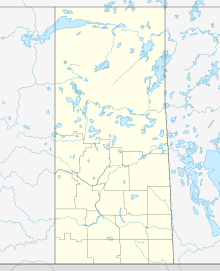 CYSF Location in Saskatchewan  CYSF CYSF (Canada) | |||||||||||
| Runways | |||||||||||
| |||||||||||
| Statistics (2010) | |||||||||||
| |||||||||||
On June 25, 2006, the airport was used to evacuate residents from northern Saskatchewan when Stony Rapids and other nearby communities were threatened by forest fires.[4]
Weather information
- Automated Weather Observation System (AWOS)
- Aviation Weather Cameras (WxCam)
Airlines and destinations
This section needs to be updated. (January 2022) |
| Airlines | Destinations |
|---|
See also
References
- Canada Flight Supplement. Effective 0901Z 16 July 2020 to 0901Z 10 September 2020.
- Synoptic/Metstat Station Information
- Total aircraft movements by class of operation
- Critic calls for new Sask. fire policy
External links
- Past three hours METARs, SPECI and current TAFs for Stony Rapids Airport from Nav Canada as available.
| By name | |
|---|---|
| By location indicator | |
| By province/territory | |
| By area | |
| National Airports System | |
| Related | |
| |
This article about an airport in Saskatchewan is a stub. You can help Wikipedia by expanding it. |
На других языках
- [en] Stony Rapids Airport
[es] Aeropuerto de Stony Rapids
El Aeropuerto de Stony Rapids (en inglés: Stony Rapids Airport) (IATA: YSF, OACI: CYSF) está ubicado adyacente a Stony Rapids, Saskatchewan, Canadá.[fr] Aéroport de Stony Rapids
L'aéroport de Stony Rapids est un aéroport situé en Saskatchewan, au Canada.Текст в блоке "Читать" взят с сайта "Википедия" и доступен по лицензии Creative Commons Attribution-ShareAlike; в отдельных случаях могут действовать дополнительные условия.
Другой контент может иметь иную лицензию. Перед использованием материалов сайта WikiSort.org внимательно изучите правила лицензирования конкретных элементов наполнения сайта.
Другой контент может иметь иную лицензию. Перед использованием материалов сайта WikiSort.org внимательно изучите правила лицензирования конкретных элементов наполнения сайта.
2019-2026
WikiSort.org - проект по пересортировке и дополнению контента Википедии
WikiSort.org - проект по пересортировке и дополнению контента Википедии