avia.wikisort.org - Aerodrome
Uranium City Airport (IATA: YBE, ICAO: CYBE) is located 4 nautical miles (7.4 km; 4.6 mi) east of Uranium City, Saskatchewan, Canada. It is classified as a Code 2 airport.[2]
Uranium City Airport | |||||||||||
|---|---|---|---|---|---|---|---|---|---|---|---|
| |||||||||||
| Summary | |||||||||||
| Airport type | Public | ||||||||||
| Operator | Ministry of Highways & Infrastructure | ||||||||||
| Location | Uranium City, Saskatchewan | ||||||||||
| Time zone | CST (UTC−06:00) | ||||||||||
| Elevation AMSL | 1,025 ft / 312 m | ||||||||||
| Coordinates | 59°33′41″N 108°28′53″W | ||||||||||
| Map | |||||||||||
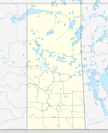 CYBE Location in Saskatchewan  CYBE CYBE (Canada) | |||||||||||
| Runways | |||||||||||
| |||||||||||
Source: Canada Flight Supplement[1] | |||||||||||
The airport was built by Eldorado Mining and Refining Limited in the 1950s to support the growing mining operations around Uranium City. Transport Canada assumed ownership in the 1970s.
After the loss of the community's mining industry, Uranium City began a sharp depopulation. The Saskatchewan provincial government assumed ownership of the airport in early 1997 from Transport Canada. The facility was downgraded two years later as its runway was shortened from 5,000 ft (1,500 m) to 3,930 ft (1,200 m), while the runway's width was halved to 100 ft (30 m).[2]
Airlines and destinations
This section does not cite any sources. (January 2022) |
| Airlines | Destinations |
|---|
See also
References
- Canada Flight Supplement. Effective 0901Z 16 July 2020 to 0901Z 10 September 2020.
- "excerpts from Athabasca Basin Transportation Planning Committee". Athabasca Economic Development & Training Corporation.
External links
- Accident history for YBE at Aviation Safety Network
Airports in Canada | |
|---|---|
| By name | |
| By location indicator | |
| By province/territory | |
| By area | |
| National Airports System | |
| Related | |
| |
This article about an airport in Saskatchewan is a stub. You can help Wikipedia by expanding it. |
На других языках
- [en] Uranium City Airport
[es] Aeropuerto de Uranium City
El Aeropuerto de Uranium City (en inglés: Uranium City Airport) (IATA: YBE, OACI: CYBE) está ubicado a 4 MN (7,4 km; 4,6 mi) al este de Uranium City, Saskatchewan, Canadá. Este aeropuerto es clasificado como un aeropuerto de código 2.[fr] Aéroport d'Uranium City
L'aéroport d'Uranium City est un aéroport situé à l'Est d'Uranium City au Canada. L'aéroport a été construit à partir de 1950 pour soutenir le développement des activités minières dans la région. À la suite de la baisse des activités minières, le gouvernement de la province reprit la gestion de l'aéroport. La piste a par ailleurs été raccourcie, passant de 1 500 à 1 200 mètres.Другой контент может иметь иную лицензию. Перед использованием материалов сайта WikiSort.org внимательно изучите правила лицензирования конкретных элементов наполнения сайта.
WikiSort.org - проект по пересортировке и дополнению контента Википедии