avia.wikisort.org - Aerodrome
Poverty Valley Aerodrome (TC LID: CPV9) is a small aerodrome located near Poverty Valley, Saskatchewan, Canada. This location is near Highway 612 south of Neidpath. McMahon is to the west, and Hodgeville to the east. Swift Current is the nearest large centre to the north west on the Trans Canada Highway.[2]
Poverty Valley Aerodrome | |||||||||||
|---|---|---|---|---|---|---|---|---|---|---|---|
| |||||||||||
| Summary | |||||||||||
| Airport type | Public | ||||||||||
| Operator | N. Amthor | ||||||||||
| Location | Whiska Creek No. 106, near Poverty Valley, Saskatchewan | ||||||||||
| Time zone | CST (UTC−06:00) | ||||||||||
| Elevation AMSL | 2,440 ft / 744 m | ||||||||||
| Coordinates | 50°02′20″N 107°15′22″W | ||||||||||
| Map | |||||||||||
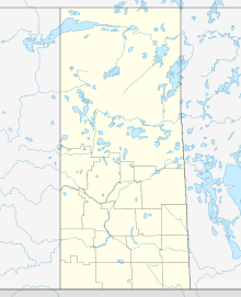 CPV9 Location in Saskatchewan  CPV9 CPV9 (Canada) | |||||||||||
| Runways | |||||||||||
| |||||||||||
Sources: Canada Flight Supplement[1] | |||||||||||
See also
References
- Canada Flight Supplement. Effective 0901Z 16 July 2020 to 0901Z 10 September 2020.
- "Google Maps +50° 2' 20.00", -107° 15' 22.00"". Retrieved 7 July 2008.
Airports in Canada | |
|---|---|
| By name | |
| By location indicator | |
| By province/territory | |
| By area | |
| National Airports System | |
| Related | |
| |
This article about an airport in Saskatchewan is a stub. You can help Wikipedia by expanding it. |
Текст в блоке "Читать" взят с сайта "Википедия" и доступен по лицензии Creative Commons Attribution-ShareAlike; в отдельных случаях могут действовать дополнительные условия.
Другой контент может иметь иную лицензию. Перед использованием материалов сайта WikiSort.org внимательно изучите правила лицензирования конкретных элементов наполнения сайта.
Другой контент может иметь иную лицензию. Перед использованием материалов сайта WikiSort.org внимательно изучите правила лицензирования конкретных элементов наполнения сайта.
2019-2025
WikiSort.org - проект по пересортировке и дополнению контента Википедии
WikiSort.org - проект по пересортировке и дополнению контента Википедии