avia.wikisort.org - Aerodrome
North Battleford/Hamlin Airport (TC LID: CJD4) was located 1 nautical mile (1.9 km; 1.2 mi) north-east of Hamlin, Saskatchewan, Canada, in the RM of North Battleford No. 437.
North Battleford/Hamlin Airport | |||||||||||||||
|---|---|---|---|---|---|---|---|---|---|---|---|---|---|---|---|
| |||||||||||||||
| Summary | |||||||||||||||
| Airport type | |||||||||||||||
| Operator | |||||||||||||||
| Location | RM of North Battleford No. 437, near Hamlin, Saskatchewan | ||||||||||||||
| Time zone | CST (UTC−06:00) | ||||||||||||||
| Elevation AMSL | 1,800 ft / 549 m | ||||||||||||||
| Coordinates | 52°52′48″N 108°17′19″W | ||||||||||||||
| Map | |||||||||||||||
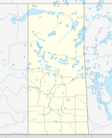 CJD4 Location in Saskatchewan  CJD4 CJD4 (Canada) | |||||||||||||||
| Runways | |||||||||||||||
| |||||||||||||||
Source: Canada Flight Supplement[1] | |||||||||||||||
History
This airfield was built under the British Commonwealth Air Training Plan during World War II as the R1 - primary relief field - for RCAF Station North Battleford. Pilots trained here using Airspeed Oxford aircraft; it is listed as operating from 4 September 1941 to 30 March 1945.[2]
Airodrome
The RCAF Aerodrome at Hamlin was the relief landing field for RCAF Station North Battleford, and was located approximately 7 mi (11 km) north of the main aerodrome. The site was located north-east of the community of Hamlin, Saskatchewan. The Relief field was constructed in the typical triangular pattern.
In approximately 1942 the aerodrome was listed as RCAF Aerodrome - Hamlin, Saskatchewan at 52°53′N 108°17′W with a variation of 22 degrees east and elevation of 1,779 ft (542 m). Six runways were listed as follows:[3]
| Runway name | Length | Width | Surface |
|---|---|---|---|
| 5/23 | 2,750 ft (840 m) | 100 ft (30 m) | Hard surfaced |
| 5/23 | 2,850 ft (870 m) | 100 ft (30 m) | Hard surfaced |
| 17/35 | 2,750 ft (840 m) | 100 ft (30 m) | Hard surfaced |
| 17/35 | 2,850 ft (870 m) | 100 ft (30 m) | Hard surfaced |
| 11/29 | 2,750 ft (840 m) | 100 ft (30 m) | Hard surfaced |
| 11/29 | 2,850 ft (870 m) | 100 ft (30 m) | Hard surfaced |
A review of Google Maps on 7 June 2018 shows clear visibility of the outer runways of the airfield. There is, however, no visibility of the inner runways. The c.1942 indicate a location on the visible triangle.[clarification needed]
Post-war, 1945–2007
More recently, one runway continued to be maintained for use in agricultural flight training by Battlefords Airspray.[4]
2007–present
As of 15 March 2007, this airport is not usable and has been removed from the Canada Flight Supplement.[2][5]
See also
References
- Canada Flight Supplement. Effective 0901Z 16 July 2020 to 0901Z 10 September 2020.
- Places to Fly - North Battleford / Hamlin (formerly RCAF Auxiliary Field Hamlin)
- Staff writer (c. 1942). Pilots Handbook of Aerodromes and Seaplane Bases Vol. 2. Royal Canadian Air Force. p. 44.
- Battlefords Airspray
- Airport changes from the Canada Flight Supplement
| By name | |
|---|---|
| By location indicator | |
| By province/territory | |
| By area | |
| National Airports System | |
| Related | |
| |
Другой контент может иметь иную лицензию. Перед использованием материалов сайта WikiSort.org внимательно изучите правила лицензирования конкретных элементов наполнения сайта.
WikiSort.org - проект по пересортировке и дополнению контента Википедии