avia.wikisort.org - Aerodrome
Coronel Horácio de Mattos Airport (IATA: LEC, ICAO: SBLE) is the airport serving Lençóis and Chapada Diamantina National Park, Brazil, located in the adjoining municipality of Coronel Octaviano Alves. It is named after Horácio Queiróz de Mattos (1882-1931), a politician who fought against the Prestes Insurrection between 1925 and 1927.
Coronel Horácio de Mattos Airport Aeroporto Coronel Horácio de Mattos | |||||||||||
|---|---|---|---|---|---|---|---|---|---|---|---|
| |||||||||||
| Summary | |||||||||||
| Airport type | Public | ||||||||||
| Serves | Lençóis | ||||||||||
| Location | Cel. Octaviano Alves (Chapada Diamantina), Brazil | ||||||||||
| Time zone | BRT (UTC−03:00) | ||||||||||
| Elevation AMSL | 506 m / 1,660 ft | ||||||||||
| Coordinates | 12°28′56″S 041°16′37″W | ||||||||||
| Map | |||||||||||
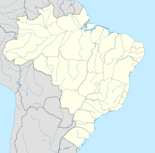  LEC Location in Brazil | |||||||||||
| Runways | |||||||||||
| |||||||||||
Airlines and destinations
| Airlines | Destinations |
|---|---|
| Azul Brazilian Airlines | Belo Horizonte–Confins (resumes 15 December 2022)[2] |
| Gol Transportes Aéreos | Salvador da Bahia (begins 9 November 2022)[3] |
Access
The airport is located at Chapada Diamantina National Park, 1 km (1 mi) from downtown Coronel Octaviano Alves and 20 km (12 mi) from downtown Lençóis.
See also


References
- "Aeródromos". ANAC (in Portuguese). 29 June 2020. Retrieved 13 May 2021.
- "Voos da Azul para mais três destinos na Bahia já estão com passagens à venda". Aeroin (in Portuguese). 13 September 2022. Retrieved 13 September 2022.
- "Polos turísticos da Bahia ganham voos da Gol com aviões ATR 72 em ligações com a capital do Estado". Aeroin (in Portuguese). 24 August 2022. Retrieved 25 August 2022.
External links
- Airport information for SBLE at Great Circle Mapper. Source: DAFIF (effective October 2006).
- Current weather for SBLE at NOAA/NWS
- Accident history for LEC at Aviation Safety Network
Airports in Bahia  | |
|---|---|
|
На других языках
- [en] Lençóis Airport
[fr] Aéroport de Lençóis
L'aéroport de Lençóis, aussi appelé aéroport Coronel Horácio de Mattos (code IATA : LEC • code OACI : SBLE) est l'aéroport desservant la ville de Lençóis et le Parc national de la Chapada Diamantina au Brésil.Текст в блоке "Читать" взят с сайта "Википедия" и доступен по лицензии Creative Commons Attribution-ShareAlike; в отдельных случаях могут действовать дополнительные условия.
Другой контент может иметь иную лицензию. Перед использованием материалов сайта WikiSort.org внимательно изучите правила лицензирования конкретных элементов наполнения сайта.
Другой контент может иметь иную лицензию. Перед использованием материалов сайта WikiSort.org внимательно изучите правила лицензирования конкретных элементов наполнения сайта.
2019-2026
WikiSort.org - проект по пересортировке и дополнению контента Википедии
WikiSort.org - проект по пересортировке и дополнению контента Википедии