avia.wikisort.org - Aerodrome
Araguaína Airport (IATA: AUX, ICAO: SWGN) is the airport serving Araguaína, Brazil.
This article needs additional citations for verification. (May 2021) |
Araguaína Airport Aeroporto de Araguaína | |||||||||||
|---|---|---|---|---|---|---|---|---|---|---|---|
 | |||||||||||
| Summary | |||||||||||
| Airport type | Public | ||||||||||
| Operator | Esaero | ||||||||||
| Serves | Araguaína | ||||||||||
| Time zone | BRT (UTC−03:00) | ||||||||||
| Elevation AMSL | 235 m / 771 ft | ||||||||||
| Coordinates | 07°13′42″S 048°14′27″W | ||||||||||
| Website | grupotw8 | ||||||||||
| Map | |||||||||||
 AUX Location in Brazil | |||||||||||
| Runways | |||||||||||
| |||||||||||
It is operated by Esaero.
History
The airport is the main gateway to the Northern region of the state of Tocantins, and Southern region of the states of Pará and Maranhão.
The airport has been renovated and works included the ramp, runway, runway lighting, and the terminal building.
Airlines and destinations
| Airlines | Destinations |
|---|---|
| Gol Transportes Aéreos | Brasília |
Access
The airport is located 8 km (5 mi) from downtown Araguaína.
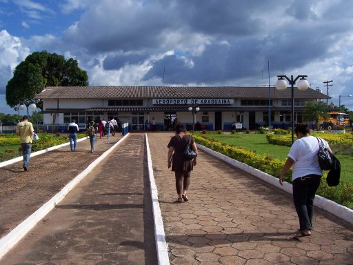
Gallery

See also
References
- "Aeroporto Regional de Araguaína (IATA: AUX ICAO: SWGN)". Esaero (in Portuguese). Retrieved 24 April 2021.
- "Aeródromos". ANAC (in Portuguese). 22 August 2019. Retrieved 11 July 2020.
External links
- Airport information for SWGN at Great Circle Mapper. Source: DAFIF (effective October 2006).
- Current weather for SWGN at NOAA/NWS
- Accident history for AUX at Aviation Safety Network
Airports in Tocantins | |
|---|---|
|
На других языках
- [en] Araguaína Airport
[fr] Aéroport d'Araguaína
L'aéroport d'Araguaína (code IATA : AUX • code OACI : SWGN) est l'aéroport desservant la ville d'Araguaína au Brésil.Текст в блоке "Читать" взят с сайта "Википедия" и доступен по лицензии Creative Commons Attribution-ShareAlike; в отдельных случаях могут действовать дополнительные условия.
Другой контент может иметь иную лицензию. Перед использованием материалов сайта WikiSort.org внимательно изучите правила лицензирования конкретных элементов наполнения сайта.
Другой контент может иметь иную лицензию. Перед использованием материалов сайта WikiSort.org внимательно изучите правила лицензирования конкретных элементов наполнения сайта.
2019-2026
WikiSort.org - проект по пересортировке и дополнению контента Википедии
WikiSort.org - проект по пересортировке и дополнению контента Википедии